IMAGES TAKEN NEAR TO
Field Lane, DERBY, DE21 4NG
Introduction
This page details the photographs taken nearby to Field Lane, DE21 4NG by members of the Geograph project.
The Geograph project started in 2005 with the aim of publishing, organising and preserving representative images for every square kilometre of Great Britain, Ireland and the Isle of Man.

There are currently over 7.5m images from over14,400 individuals and you can help contribute to the project by visiting https://www.geograph.org.uk
Image Map
Images are licensed for reuse under creativecommons.org/licenses/by-sa/2.0
Notes
- Clicking on the map will re-center to the selected point.
- The higher the marker number, the further away the image location is from the centre of the postcode.
Image Listing (11 Images Found)
Images are licensed for reuse under creativecommons.org/licenses/by-sa/2.0
Image
Details
Distance
2
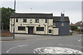
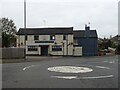
Steaming Billy Brewing Company
This is a public house that, I assume, brews its own beer from the name on the side of the building. It is at the triple junction of Wood Road, Morely Road and Chaddesden Lane.
Image: © Malcolm Neal
Taken: 20 Jun 2017
0.11 miles
3
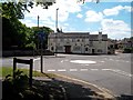
The Wilmot Arms in Chaddesden
The Chaddesden Historical Group website lists this as the oldest surviving public house in the village. It dates back to the early 19th century when it was known as The Wheel Inn.
Image: © Jonathan Clitheroe
Taken: 1 Jun 2013
0.12 miles
6
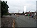
Max Road junction with Wood Road, Chaddesden
Image: © JThomas
Taken: 2 Nov 2024
0.16 miles
7
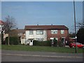
Prefabs Chaddesden
Prefabs in Chaddesden, just meant to last a few years after the Second World War still going strong some 60 years later!
https://web.archive.org/web/20060625160132/http://www.picturesofderby.co.uk/area_chaddesden%20page%203.htm
2015 edit: The houses are not traditional post WWII temporary prefabs; they are BISF (British Iron & Steel Federation) houses which were designed and built immediately after the war to be permanent structures. Many still survive around the country. Here is a https://en.wikipedia.org/wiki/BISF_house to the BISF Wikipedia article.
Image: © mike smith
Taken: Unknown
0.19 miles
8
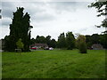
Open space and Appleton Close, Chaddesden
Image: © Jonathan Thacker
Taken: 4 Aug 2024
0.21 miles
9
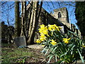
St Mary's Church Chaddesden
Photo taken from a path alongside the churchyard. This path is approximately 1 to 1.5m lower than the land level of the churchyard/burial ground. The church was founded in 1347.
Image: © Michael Fitchett
Taken: 21 Mar 2008
0.23 miles