
IMAGES TAKEN NEAR TO
Egmanton Close, DERBY, DE21 2EL
Introduction
This page details the photographs taken nearby to Egmanton Close, DE21 2EL by members of the Geograph project.
The Geograph project started in 2005 with the aim of publishing, organising and preserving representative images for every square kilometre of Great Britain, Ireland and the Isle of Man.

There are currently over 7.5m images from over14,400 individuals and you can help contribute to the project by visiting https://www.geograph.org.uk
Image Map
Images are licensed for reuse under creativecommons.org/licenses/by-sa/2.0
Notes
- Clicking on the map will re-center to the selected point.
- The higher the marker number, the further away the image location is from the centre of the postcode.
Image Listing (7 Images Found)
Images are licensed for reuse under creativecommons.org/licenses/by-sa/2.0
Image
Details
Distance
1
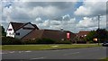
Oak and Acorn, Oakwood
Pub in suburban Derby.
Image: © Peter Barr
Taken: 11 Jul 2011
0.18 miles
2
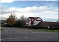
Public House in Oakwood
The Oak and Acorn Public House situated on the corner of Bishops Drive and Danebridge Crescent.
Image: © Jonathan Clitheroe
Taken: 2 Nov 2014
0.19 miles
5
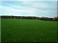
Sports Fields near Oakbrook Leisure Centre
Football pitches viewed from Bishops Drive.
Image: © Jonathan Clitheroe
Taken: 2 Nov 2014
0.22 miles
6

Site of a farm being developed
On Morley Road, Oakwood, Derby.
Image: © Peter Barr
Taken: 11 Jul 2011
0.23 miles
7
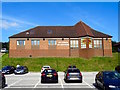
The Church on Oakwood
The Church on Oakwood first opened at Easter 1993 and is an ecumenical partnership of Roman Catholics, Anglicans, Methodists and the United Reformed Church.
Image: © Ian Calderwood
Taken: 24 Aug 2016
0.25 miles