
IMAGES TAKEN NEAR TO
Acer Croft, DERBY, DE21 2EG
Introduction
This page details the photographs taken nearby to Acer Croft, DE21 2EG by members of the Geograph project.
The Geograph project started in 2005 with the aim of publishing, organising and preserving representative images for every square kilometre of Great Britain, Ireland and the Isle of Man.

There are currently over 7.5m images from over14,400 individuals and you can help contribute to the project by visiting https://www.geograph.org.uk
Image Map
Images are licensed for reuse under creativecommons.org/licenses/by-sa/2.0
Notes
- Clicking on the map will re-center to the selected point.
- The higher the marker number, the further away the image location is from the centre of the postcode.
Image Listing (15 Images Found)
Images are licensed for reuse under creativecommons.org/licenses/by-sa/2.0
Image
Details
Distance
1
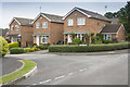
Calver Close
Right on the edge of Derby - Calver Close is very close to the A608 Mansfield Road, though here I think it is called Hill Top.
This is one of the older areas of this huge development on the NE side of Derby. Having said that it is not a very old development and compared to many areas of Derby is modern.
Image: © Malcolm Neal
Taken: 20 Jun 2017
0.07 miles
2
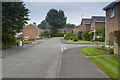
Rye Close
A housing development on the very N edge of Oakwood, Derby.
Image: © Malcolm Neal
Taken: 20 Jun 2017
0.07 miles
3
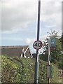
UK 40 Speed Sign
UK 40 Speed Sign on Hill Top, Derby Derbyshire.
Image: © gary
Taken: 29 Aug 2016
0.11 miles
4
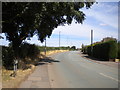
Hill Top, Breadsall Hilltop
Part of the A608 towards Heanor.
Image: © Richard Vince
Taken: 11 Aug 2018
0.16 miles
6
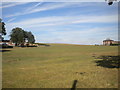
Field north of Breadsall Hilltop (1)
Host to an invisible public footpath.
Image: © Richard Vince
Taken: 11 Aug 2018
0.18 miles
8
Bishops Drive at Breadsall Hilltop
The junction with Minster Road is next right.
Image: © Jonathan Clitheroe
Taken: 14 Mar 2015
0.19 miles
9
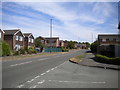
Bishop's Drive, Oakwood
Looking towards Oakwood centre from the junction with Corbel Close.
Image: © Richard Vince
Taken: 11 Aug 2018
0.19 miles
10
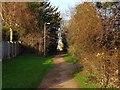
Old line of Porter's Lane
This footpath follows the old line of Porter's Lane from before it was swallowed by Oakwood.
Image: © Ian Calderwood
Taken: 13 Dec 2018
0.19 miles