
IMAGES TAKEN NEAR TO
Rochley Close, DERBY, DE21 2AU
Introduction
This page details the photographs taken nearby to Rochley Close, DE21 2AU by members of the Geograph project.
The Geograph project started in 2005 with the aim of publishing, organising and preserving representative images for every square kilometre of Great Britain, Ireland and the Isle of Man.

There are currently over 7.5m images from over14,400 individuals and you can help contribute to the project by visiting https://www.geograph.org.uk
Image Map
Images are licensed for reuse under creativecommons.org/licenses/by-sa/2.0
Notes
- Clicking on the map will re-center to the selected point.
- The higher the marker number, the further away the image location is from the centre of the postcode.
Image Listing (8 Images Found)
Images are licensed for reuse under creativecommons.org/licenses/by-sa/2.0
Image
Details
Distance
1
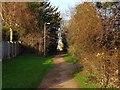
Old line of Porter's Lane
This footpath follows the old line of Porter's Lane from before it was swallowed by Oakwood.
Image: © Ian Calderwood
Taken: 13 Dec 2018
0.05 miles
2
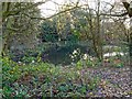
Porter's Lane Pond
An old field pond, swallowed up by the building of Oakwood.
Image: © Ian Calderwood
Taken: 13 Dec 2018
0.12 miles
3
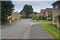
Rye Close
A housing development on the very N edge of Oakwood, Derby.
Image: © Malcolm Neal
Taken: 20 Jun 2017
0.12 miles
4
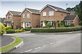
Calver Close
Right on the edge of Derby - Calver Close is very close to the A608 Mansfield Road, though here I think it is called Hill Top.
This is one of the older areas of this huge development on the NE side of Derby. Having said that it is not a very old development and compared to many areas of Derby is modern.
Image: © Malcolm Neal
Taken: 20 Jun 2017
0.13 miles
6
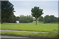
Open space off Bishops Drive
This large open space is off Bishops Drive. You can just see a caravan which is one of many Gypsy / Romany / Traveller caravans who have all parked on this space and have been there for some time.
Image: © Malcolm Neal
Taken: 20 Jun 2017
0.23 miles
7
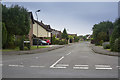
Amesbury Lane
Yet another leafy lane in Oakwood - the large housing estate to the NE of Derby.
Image: © Malcolm Neal
Taken: 20 Jun 2017
0.24 miles
8
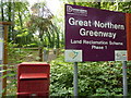
Great Northern Greenway
The former Great Northern Railway ran through Derby City to Ilkeston and beyond into Nottingham and was known locally as the Friargate Line.
The passenger railway was closed in the 1960’s and for many years it has been identified for redevelopment as a traffic free transport route and recreational amenity. The realisation of this route as a countryside trail is finally gathering steam.
We completed the first 1.5miles, between Mansfield Road in Derby City to Brookside Road in Breadsall Village, in November 2009.
The trail has an all weather surface and provides easy access all year round for walkers, families with prams, mobility scooters, cyclists and horse riders.
This route passes through the Breadsall Wildlife Site.
(Notes from DCC site.)
Image: © Peter Barr
Taken: 9 Jul 2011
0.25 miles