
IMAGES TAKEN NEAR TO
Carnarvon Court, BURTON-ON-TRENT, DE15 0UA
Introduction
This page details the photographs taken nearby to Carnarvon Court, DE15 0UA by members of the Geograph project.
The Geograph project started in 2005 with the aim of publishing, organising and preserving representative images for every square kilometre of Great Britain, Ireland and the Isle of Man.

There are currently over 7.5m images from over14,400 individuals and you can help contribute to the project by visiting https://www.geograph.org.uk
Image Map
Images are licensed for reuse under creativecommons.org/licenses/by-sa/2.0
Notes
- Clicking on the map will re-center to the selected point.
- The higher the marker number, the further away the image location is from the centre of the postcode.
Image Listing (13 Images Found)
Images are licensed for reuse under creativecommons.org/licenses/by-sa/2.0
Image
Details
Distance
2
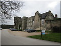
Bretby Hall, east side
Largely dates from 1815. The main facade is on the south side http://www.britishlistedbuildings.co.uk/en-82806-bretby-hall-bretby-derbyshire#.Vp1vnFmWMnA
Image: © Jonathan Thacker
Taken: 21 Mar 2015
0.04 miles
3
Bridleway from Nether Hall
Entering the Bretby Hall campus.
Image: © Jonathan Thacker
Taken: 21 Mar 2015
0.04 miles
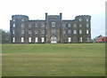
6
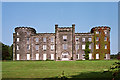
Bretby Park, Bretby
Built by the fifth Earl of Chesterfield, begun in 1813 and unfinished when he died in 1815. This show front was probably designed by Jeffry Wyatville. Grade II* listed.
For much of the C20th it housed a hospital, but has now been converted to flats.
Image: © Stephen Richards
Taken: 27 Aug 2002
0.06 miles
7
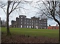
Bretby Hall
Pictured from the public footpath which runs in front of the facade.
Image: © Jonathan Clitheroe
Taken: 28 Mar 2015
0.06 miles
9

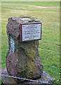
Commemorative plaque
Since its closure as a hospital in 1997 Bretby Hall has been converted into apartments.
Image: © Jonathan Thacker
Taken: 21 Mar 2015
0.08 miles
10

Lakes at Bretby Hall
The lakes viewed from the footpath running along the Southern edge of Bretby Hall. The strip of land separating these two lakes provides the crossing point of the footpath from Bretby to Hoolies wood and from there to either Upper Midway or Hartshorne.
Image: © Mark Walton
Taken: 10 Apr 2007
0.11 miles