
IMAGES TAKEN NEAR TO
Gainsborough Way, BURTON-ON-TRENT, DE15 0HY
Introduction
This page details the photographs taken nearby to Gainsborough Way, DE15 0HY by members of the Geograph project.
The Geograph project started in 2005 with the aim of publishing, organising and preserving representative images for every square kilometre of Great Britain, Ireland and the Isle of Man.

There are currently over 7.5m images from over14,400 individuals and you can help contribute to the project by visiting https://www.geograph.org.uk
Image Map
Images are licensed for reuse under creativecommons.org/licenses/by-sa/2.0
Notes
- Clicking on the map will re-center to the selected point.
- The higher the marker number, the further away the image location is from the centre of the postcode.
Image Listing (6 Images Found)
Images are licensed for reuse under creativecommons.org/licenses/by-sa/2.0
Image
Details
Distance
1
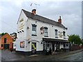
The Anglesey Arms
Described by Marston's as a "traditional wet only venue with a strong cask ale offer and regular weekly schedule of events including games, bingo, quiz and auctions".
Image: © Ian Calderwood
Taken: 1 Aug 2020
0.06 miles
4
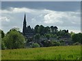
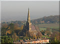
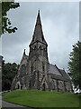
St. Mark's Church, Winshill
From the fields behind Mount Pleasant Residential Home.
Image: © John Beresford
Taken: Unknown
0.10 miles
5
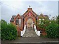
St. Joseph the Worker
A Catholic Chapel of Ease in the former Winshill Institute building.
Image: © Ian Calderwood
Taken: 1 Aug 2020
0.16 miles
6
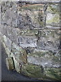
OS benchmark - Winshill, Ashby Road
An OS cutmark on the roadside wall, at the junction with Rowbury Drive; originally levelled at 90.346m above Ordnance Datum Newlyn.
Image: © Richard Law
Taken: 21 Oct 2014
0.25 miles