
IMAGES TAKEN NEAR TO
Thrift Road, BURTON-ON-TRENT, DE14 3LJ
Introduction
This page details the photographs taken nearby to Thrift Road, DE14 3LJ by members of the Geograph project.
The Geograph project started in 2005 with the aim of publishing, organising and preserving representative images for every square kilometre of Great Britain, Ireland and the Isle of Man.

There are currently over 7.5m images from over14,400 individuals and you can help contribute to the project by visiting https://www.geograph.org.uk
Image Map
Images are licensed for reuse under creativecommons.org/licenses/by-sa/2.0
Notes
- Clicking on the map will re-center to the selected point.
- The higher the marker number, the further away the image location is from the centre of the postcode.
Image Listing (13 Images Found)
Images are licensed for reuse under creativecommons.org/licenses/by-sa/2.0
Image
Details
Distance
1
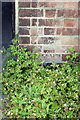
Benchmark on #272 Anglesey Road
Ordnance Survey cut mark benchmark described on the Bench Mark Database at http://www.bench-marks.org.uk/bm48774
Image: © Roger Templeman
Taken: 25 May 2013
0.13 miles
2
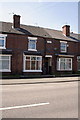
Houses of Whitcliffe Place, Anglesey Road
There is an OS benchmark Image on the bricks to the right of the door entrance
Image: © Roger Templeman
Taken: 25 May 2013
0.13 miles
3

View across the rails
View across Birmingham South Curve Junction at Branston, with the now demolished Drakelow power station in the background. All the land on the far side of the rails has now been subjected to housing development.
Image: © Chris Eaton
Taken: 24 Jul 1990
0.15 miles
4
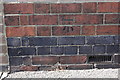
Benchmark on #110 Beech Street
Ordnance Survey cut mark benchmark described on the Bench Mark Database at http://www.bench-marks.org.uk/bm48773
Image: © Roger Templeman
Taken: 25 May 2013
0.16 miles
5
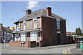
Junctions of All Saints Road with Beech Street and Anglesey Road
There is an OS benchmark Image on the near corner of the house at the junction with the front garden wall
Image: © Roger Templeman
Taken: 25 May 2013
0.16 miles
6
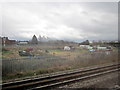
Allotments, Leicester Junction, Burton-Upon-Trent
Image: © Roy Hughes
Taken: 16 Mar 2013
0.18 miles
7
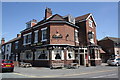
The New Talbot, junction of South Oak Street and Anglesey Road
Anglesey Road is the B5017
Image: © Roger Templeman
Taken: 25 May 2013
0.19 miles
9
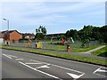
Regents Park Play Area
The play area and outdoor gym was opened on Thursday 10th March 2016 by the Mayor of East Staffordshire.
Image: © Ian Calderwood
Taken: 4 Jul 2019
0.23 miles
10
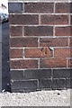
Benchmark on #59 All Saints Road
Ordnance Survey cut mark benchmark described on the Bench Mark Database at http://www.bench-marks.org.uk/bm48775
Image: © Roger Templeman
Taken: 25 May 2013
0.23 miles