
IMAGES TAKEN NEAR TO
Rowan Drive, BURTON-ON-TRENT, DE14 3HQ
Introduction
This page details the photographs taken nearby to Rowan Drive, DE14 3HQ by members of the Geograph project.
The Geograph project started in 2005 with the aim of publishing, organising and preserving representative images for every square kilometre of Great Britain, Ireland and the Isle of Man.

There are currently over 7.5m images from over14,400 individuals and you can help contribute to the project by visiting https://www.geograph.org.uk
Image Map
Images are licensed for reuse under creativecommons.org/licenses/by-sa/2.0
Notes
- Clicking on the map will re-center to the selected point.
- The higher the marker number, the further away the image location is from the centre of the postcode.
Image Listing (19 Images Found)
Images are licensed for reuse under creativecommons.org/licenses/by-sa/2.0
Image
Details
Distance
1
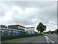
Slip road onto A38 east of Branston Water Park
Image: © David Smith
Taken: 1 Sep 2023
0.11 miles
2
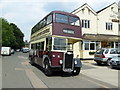
Vintage Bus visits Branston Public House
Ex Burton Corporation 1949 Guy Arab III, FA 9716, on one of its summer runs, which on this occasion took it to the village of Branston. It is parked on what once was the main A38 trunk road through Branston, which, since the completion of the A38 dual carriageway, has left the Gate Inn, (background), literally at the end of a long cul-de sac - but the beer is as good as ever!
Image: © Chris Eaton
Taken: 26 Jun 2010
0.12 miles
3
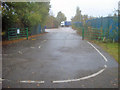
Main entrance to Branston Water Park
Looking out of the park to the busy A38. This is a very discreet entrance, which passes through an industrial site before turning sharply here towards the car park. Luckily it is well signposted from the A38.
Image: © Trevor Rickard
Taken: 24 Oct 2009
0.14 miles
4
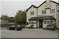
The Gate Inn
A strange place for a pub. It is at the end of Main Street but this is a cul-de-sac immediately alongside the A38 trunk road. Main Street appears, now, never to have gone anywhere, but perhaps it did before the A38 dual carriageway was constructed.
Image: © Malcolm Neal
Taken: 9 Aug 2018
0.15 miles
5
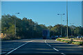
Branston : Lichfield Road A38
Heading along the A38.
Image: © Lewis Clarke
Taken: 26 Sep 2020
0.15 miles
7
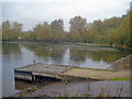
Platform and boat launch at Branston Water Park
Looking across the east end of the lake with the car park just in view.
Image: © Trevor Rickard
Taken: 24 Oct 2009
0.17 miles
8
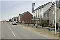
Yet more new houses
On a large scale map this development is not marked but on a smaller scale view it is present. Some houses have been built but it looks like there are many more to come.
Image: © Malcolm Neal
Taken: 9 Aug 2018
0.17 miles
9
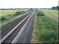
River Trent floodplain south of Branston, Staffordshire
The River Trent flows north-eastwards by the line of trees in the top right of the picture. The flood plain on either side of the railway line is former gravel pits that were filled in with flyash from nearby Drakelow Power Station during the 1960s and early 70s. The land is now partly used for rough grazing (sheep). The village of Branston (original home of the famous pickle) is clearly visible in the distance, on and beyond the northern edge of the grid square. Some taller buildings (namely the tower of Coors maltings) of the brewery town of Burton upon Trent are just visible beyond Branston. An early evening Virgin Voyager express train hurries from Birmingham, towards Burton upon Trent and Derby. The photograph was taken looking north-eastwards, at 19.27 hours, from the top of a recently erected footbridge over the railway and which as yet does not appear on any OS maps.
Image: © Alan Slater
Taken: 18 Jun 2006
0.19 miles
10

Woodland path at the Branston Water Park - 1
Leading through the woodland on the eastern side of the lake.
Image: © Trevor Rickard
Taken: 24 Oct 2009
0.20 miles