
IMAGES TAKEN NEAR TO
Cardean Close, DERBY, DE1 3QG
Introduction
This page details the photographs taken nearby to Cardean Close, DE1 3QG by members of the Geograph project.
The Geograph project started in 2005 with the aim of publishing, organising and preserving representative images for every square kilometre of Great Britain, Ireland and the Isle of Man.

There are currently over 7.5m images from over14,400 individuals and you can help contribute to the project by visiting https://www.geograph.org.uk
Image Map
Images are licensed for reuse under creativecommons.org/licenses/by-sa/2.0
Notes
- Clicking on the map will re-center to the selected point.
- The higher the marker number, the further away the image location is from the centre of the postcode.
Image Listing (50 Images Found)
Images are licensed for reuse under creativecommons.org/licenses/by-sa/2.0
Image
Details
Distance
1
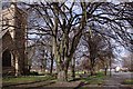
Chester Green
This is a popular residential area just north of Derby City Centre, St Paul's church is on the left, and the Mansfield Road to the right in this picture.
Image: © Jerry Evans
Taken: 27 Feb 2008
0.08 miles
2
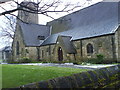
St Paul's Church, Chester Green, Derby
Taken on a crisp February morning in 2007.
The church was built by Barry & Brown in 1849, the aisle was added in 1897
More info on the church & area can be found on:
http://www.stpaulschestergreen.org/about.htm
Image: © Ally Walker
Taken: Unknown
0.09 miles
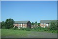
4
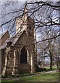
St Paul's Church, Chester Green
This attractively situated church dates from 1850.
Image: © Jerry Evans
Taken: 27 Feb 2008
0.10 miles
5
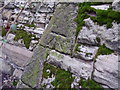
Bench mark on St Paul's Church
This bench mark was established in 1851 during the First primary levelling of England & Wales, and was levelled with a height of 158.1520 feet [48.2047 metres] above mean sea level (Liverpool datum). It was included on the Sheffield to Birmingham levelling line. The surveyor's description was "No. 132. Bolt in North-east corner of St. Paul's Church tower, Little Chester ; 2.20 ft. above surface" (p359). The 1883 town plan shows this mark which is on the south-east face, at the south corner, on a sloping face of the buttress behind a shrub.
Image: © Shantavira
Taken: 14 Mar 2015
0.11 miles
6
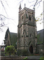
Derby - St Paul's Church
On Chester Green. For an alternative view, please see Image
Image: © Dave Bevis
Taken: 2 Dec 2011
0.12 miles
8

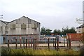
Smith's Partnership building
The large and relatively new building houses the group of solicitors known as the Smith Partnership.
This is the final 100 metre square in SK3536 so I now have at least one image in every 100 metre square in the whole of the 1km square.
Image: © Malcolm Neal
Taken: 20 Aug 2019
0.14 miles
9
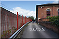
The side of Derwent Business Centre
Another building that houses a variety of small businesses, mostly white colar businesses from the look of it.
Image: © Malcolm Neal
Taken: 20 Aug 2019
0.15 miles
10
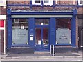
Little Chester Ale House
A micropub that opened in a former dry cleaners in November 2012, offering a choice of five real ales and a cider.
Image: © Ian Calderwood
Taken: 12 Aug 2013
0.15 miles