
IMAGES TAKEN NEAR TO
St. Johns Terrace, DERBY, DE1 3LJ
Introduction
This page details the photographs taken nearby to St. Johns Terrace, DE1 3LJ by members of the Geograph project.
The Geograph project started in 2005 with the aim of publishing, organising and preserving representative images for every square kilometre of Great Britain, Ireland and the Isle of Man.

There are currently over 7.5m images from over14,400 individuals and you can help contribute to the project by visiting https://www.geograph.org.uk
Image Map
Images are licensed for reuse under creativecommons.org/licenses/by-sa/2.0
Notes
- Clicking on the map will re-center to the selected point.
- The higher the marker number, the further away the image location is from the centre of the postcode.
Image Listing (294 Images Found)
Images are licensed for reuse under creativecommons.org/licenses/by-sa/2.0
Image
Details
Distance
1

Derby - Bridge Street Area
Looking along St John's Terrace towards Bridge Street. This unadopted private road runs parallel with a tributary - Markeaton Brook - that flows into the River Derwent and most of the owners of these properties have created small decked areas at the side of the brook in order to be able to enjoy fresh air and relaxation when the weather permits. The Brook reaches the Derwent at two points, in Darley Park and at Basses Recreation Ground to become part of the River Trent catchment. On the opposite bank lies the church yard of St John the Evangelist, Bridge Street,
Image: © David Hallam-Jones
Taken: 29 Nov 2012
0.01 miles
2

St. John's Terrace
The picture is taken from the Garden of Rest in the grounds of St. John's Church. The terrace has in front of it and just visible, the Markeaton Brook which soon runs in a culvert to stop city centre flooding.
Image: © Malcolm Neal
Taken: 24 May 2022
0.01 miles
3

St. John's Terrace
The terrace is a private road with the Markeaton Brook to the immediate left of the road. On the other side of the brook is St John's Church an Anglican church.
Image: © Malcolm Neal
Taken: 22 Oct 2019
0.01 miles
4

Markeaton Brook
Taken from the bridge on Nun's Street, Markeaton Brook forms a natural oasis in this heavily built up area.
Image: © J147
Taken: 23 Sep 2007
0.02 miles
5
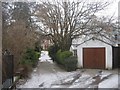
Saint Johns Terrace, Derby
Looking down Saint Johns Terrace from its junction with Bridge Street in Derby.
Image: © Eamon Curry
Taken: 5 Jan 2010
0.03 miles
6

Derby - St John's Church - window detail
For a wider view of this church on Bridge Street, please see Image
Image: © Dave Bevis
Taken: 3 Oct 2014
0.03 miles
7

The Markeaton Brook
The Markeaton Brook runs through the centre of Derby. It used to cause very bad floods but is now mostly culverted which reduces the danger.
Image: © Malcolm Neal
Taken: 29 Oct 2019
0.03 miles
8
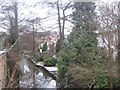
Saint Johns Terrace, Derby
Looking down Saint Johns Terrace from its junction with Bridge Street with Markeaton Brook in Derby.
Image: © Eamon Curry
Taken: 5 Jan 2010
0.03 miles
9

St. John the Evangelist Church
A stone built church near the centre of Derby.
Image: © Malcolm Neal
Taken: 8 Oct 2019
0.03 miles
10

Bench mark on St John's Church
This bench mark was established in 1851 during the First primary levelling of England & Wales, and was levelled with a height of 170.7290 feet [52.0382 metres] above mean sea level (Liverpool datum). It was included as a side level on the Sheffield to Birmingham levelling line. The surveyor's description was "No. 139(g). St. John's Church, Bridge-street. Bolt in West side of South tower ; 1.97 ft. above surface" (p359). The 1883 town plans show this mark which is on the south face of the north-west turret.
Image: © Shantavira
Taken: 14 Mar 2015
0.04 miles