
IMAGES TAKEN NEAR TO
Kingston Street, DERBY, DE1 3EZ
Introduction
This page details the photographs taken nearby to Kingston Street, DE1 3EZ by members of the Geograph project.
The Geograph project started in 2005 with the aim of publishing, organising and preserving representative images for every square kilometre of Great Britain, Ireland and the Isle of Man.

There are currently over 7.5m images from over14,400 individuals and you can help contribute to the project by visiting https://www.geograph.org.uk
Image Map
Images are licensed for reuse under creativecommons.org/licenses/by-sa/2.0
Notes
- Clicking on the map will re-center to the selected point.
- The higher the marker number, the further away the image location is from the centre of the postcode.
Image Listing (101 Images Found)
Images are licensed for reuse under creativecommons.org/licenses/by-sa/2.0
Image
Details
Distance
1
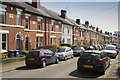
Otter Street
An area of terraced or palisaded houses that is quite old. Many of them have undergone extension renovation, but as you can see, parking is a big problem.
Image: © Malcolm Neal
Taken: 8 Apr 2017
0.06 miles
2

A new boathouse?
The steel framework looks very new and is clearly not yet complete. It is behind the fence that protects Derwent Rowing Club, and I am guessing that it will become a new boathouse. It seems the right length to house 8's.
Image: © Malcolm Neal
Taken: 26 Dec 2020
0.07 miles
3
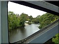
The River Derwent
On the left of the river are the slipways of the Derby Rowing Club. The photograph was taken through the girders of a disused railway bridge.
Image: © Graham Hogg
Taken: 17 Oct 2011
0.09 miles
4
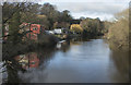
Boat houses on the Derwent
The two buildings are the club and boat houses of the two Derby Rowing Clubs; The Derby Rowing Club and the Derwent Rowing Club. The river is quite full but a long way from flooding.
Image: © Malcolm Neal
Taken: 1 Jan 2018
0.09 miles
5

Darley Park: remains of the Duke Street Branch - 3
Just some bushes in a park, it would seem - but from 1878 until the early 1950s a goods-only branch line diverged from the Great Northern line to Derby Friargate just east of the Handyside Bridge over the Derwent and ran parallel to Darley Grove for about a third of a mile; trains then reversed southwards and passed under the Friargate Line to sidings in and around Duke Street, serving a number of mills and workshops, including Handyside's Britannia Foundry and Bath Street Mills. The Duke Street Branch closed completely by 1956, was quickly dismantled and few traces of it now remain, especially at Duke Street.
This picture shows, between the bushes, the north end of the headshunt; I stood on where the rails once were to press the shutter.
See Image] and Image
Image: © John Sutton
Taken: 25 Mar 2011
0.11 miles
6
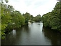
The River Derwent
On the left (west) bank of the river are the slipways of the Derby Rowing Club.
Image: © Graham Hogg
Taken: 17 Oct 2011
0.11 miles
7

Cricket ground and pavilion, Little Chester
In an area of Derby called Little Chester; the site of Derventio Roman fort is just north of here.
Image: © Peter Barr
Taken: 25 Aug 2010
0.12 miles
8
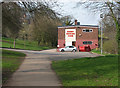
Remains of the Duke Street Branch - 1
To the eye of anyone other than the most committed railway enthusiast, this is a picture of Derby Rowing Club and a path in Darley Park. However, From 1878 until the early 1950s a goods-only branch line diverged from the Great Northern line to Derby Friargate just east of the Handyside Bridge over the Derwent and ran parallel to Darley Grove (beyond the trees on the left) for about a third of a mile; trains then reversed southwards along the line of this path and passed through a bridge under the Friargate Line to sidings in and around Duke Street (behind the camera), serving a number of mills and workshops, including Handyside's Britannia Foundry and Bath Street Mills. The Duke Street Branch closed completely by 1956, was quickly dismantled and few traces of it now remain, especially at Duke Street. The trackbed is now a riverside footpath, and the Handyside Bridge (offstage right) is also a footway, to Chester Green.
See Image] and Image
Image: © John Sutton
Taken: 25 Mar 2011
0.12 miles
9
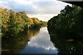
The River Derwent
Looking downstream from Handyside Bridge.
Image: © David Lally
Taken: 26 Oct 2008
0.13 miles
10

Darley Grove
Darley Grove is an adjunct to Darley Park and the new path, just visible, goes all the way to the park cafe - to the left, and to the right past the two rowing clubs.
Image: © Malcolm Neal
Taken: 26 Dec 2020
0.13 miles