
IMAGES TAKEN NEAR TO
The Balk, BURTON-ON-TRENT, DE13 9NP
Introduction
This page details the photographs taken nearby to The Balk, DE13 9NP by members of the Geograph project.
The Geograph project started in 2005 with the aim of publishing, organising and preserving representative images for every square kilometre of Great Britain, Ireland and the Isle of Man.

There are currently over 7.5m images from over14,400 individuals and you can help contribute to the project by visiting https://www.geograph.org.uk
Image Map
Images are licensed for reuse under creativecommons.org/licenses/by-sa/2.0
Notes
- Clicking on the map will re-center to the selected point.
- The higher the marker number, the further away the image location is from the centre of the postcode.
Image Listing (13 Images Found)
Images are licensed for reuse under creativecommons.org/licenses/by-sa/2.0
Image
Details
Distance
1
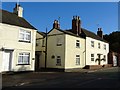
Leopard Corner
Formerly the Spotted Leopard public house. The black leopard was on the coat of arms of the Mosley family of Rolleston.
Image: © Ian Calderwood
Taken: 27 Oct 2017
0.06 miles
2
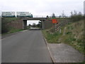
Bridge and Path
The bridge carries the A511 over the road between Rolleston and Tutbury. The footpath with the To Let sign is a short local path.
Image: © Michael Patterson
Taken: 15 Mar 2007
0.12 miles
6
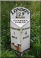
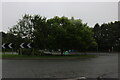
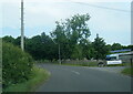
Old Milepost by the A511, Burton Road, Tutbury parish
Cast iron post by the A511 (was A50), in parish of Tutbury (East Staffordshire District), South end of Tutbury by-pass, just East of roundabout, on the verge at base of bank, on West side of road. Thornewill iron casting, erected by the Ashby de la Zouch to Tutbury turnpike trust in the 19th century.
Inscription reads:-
: TUTBURY / ½ / MILES : : LONDON / 129 / MILES / TUTBURY / PARISH : : BURTON / 4 / MILES :
Maker:-
: THORNEWILL / BURTON :
Grade II listed.
List Entry Number: 1392046 https://historicengland.org.uk/listing/the-list/list-entry/1392046
Milestone Society National ID: ST_BTTT04
Image: © Mike Faherty
Taken: Unknown
0.17 miles
7
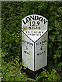
Milepost near Tutbury
See http://www.geograph.org.uk/photo/3987077 for location.
Image: © Alan Murray-Rust
Taken: 15 May 2014
0.18 miles
9
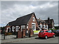
Tutbury Pre-school
Situated in a former primary school.
Image: © Jonathan Thacker
Taken: 15 Aug 2019
0.19 miles
10
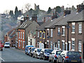
Burton Street, Tutbury
Part of the traditional main road through Tutbury, once the A50, with the castle on the hill behind.
Image: © Alan Murray-Rust
Taken: 21 Feb 2014
0.21 miles