
IMAGES TAKEN NEAR TO
Ferrers Avenue, BURTON-ON-TRENT, DE13 9JJ
Introduction
This page details the photographs taken nearby to Ferrers Avenue, DE13 9JJ by members of the Geograph project.
The Geograph project started in 2005 with the aim of publishing, organising and preserving representative images for every square kilometre of Great Britain, Ireland and the Isle of Man.

There are currently over 7.5m images from over14,400 individuals and you can help contribute to the project by visiting https://www.geograph.org.uk
Image Map
Images are licensed for reuse under creativecommons.org/licenses/by-sa/2.0
Notes
- Clicking on the map will re-center to the selected point.
- The higher the marker number, the further away the image location is from the centre of the postcode.
Image Listing (35 Images Found)
Images are licensed for reuse under creativecommons.org/licenses/by-sa/2.0
Image
Details
Distance
1
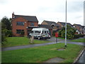
Houses on Redhill Lane, Owens Bank
Showing position of Postbox No. DE13 1193.
See Image] for postbox.
Image: © JThomas
Taken: 27 Aug 2016
0.15 miles
2
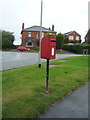
Elizabeth II postbox, Owens Bank
Image: © JThomas
Taken: 27 Aug 2016
0.15 miles
3
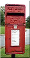
Close up, Elizabeth II postbox, Owens Bank
Postbox No. DE13 1193.
See Image] for wider view.
Image: © JThomas
Taken: 27 Aug 2016
0.15 miles
4
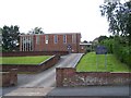
St Christopher's Catholic Church, Tutbury
On Wakefield Avenue.
Served from the Catholic Church in Barton-Under-Needwood
Image: © Geoff Pick
Taken: 20 Jul 2010
0.16 miles
5
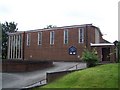
St Christopher's Catholic Church, Tutbury
On Wakefield Avenue. Served from the Catholic Church in Barton-Under-Needwood
Image: © Geoff Pick
Taken: 20 Jul 2010
0.16 miles
6
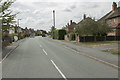
Park Lane
Park Lane is on the very edge of Tutbury. This is a small village with a famous ruined castle. The castle Housed Mary Queen of Scots for some time.
Image: © Malcolm Neal
Taken: 9 Aug 2018
0.16 miles
7
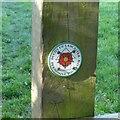
On the Tutbury Heritage Walk
Permissive footpath waymark at the section of the Park Pale at Park Lane http://www.geograph.org.uk/photo/5592400 .
Image: © Alan Murray-Rust
Taken: 17 Oct 2017
0.16 miles
8
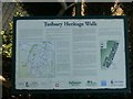
On the Tutbury Heritage Walk
One of several information boards set up along the line of the walk, this one is just off Park Lane.
Image: © Alan Murray-Rust
Taken: 17 Oct 2017
0.16 miles
10
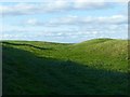
Tutbury Park Pale
Ditch and bank forming part of the boundary of the park attached to Tutbury Castle. Although the Park Pale is a medieval creation, probably dating from around the building of the castle in the 11th century, it has been tentatively suggested that this section my have originated as an Iron Age hill fort. This and the two other sections of the Park Pale are protected as a Scheduled Monument. Made accessible as part of the Tutbury Heritage Walk through a permissive footpath http://www.geograph.org.uk/photo/5592415 courtesy of the Duchy of Lancaster.
Image: © Alan Murray-Rust
Taken: 17 Oct 2017
0.18 miles