
IMAGES TAKEN NEAR TO
Church Street, BURTON-ON-TRENT, DE13 9JB
Introduction
This page details the photographs taken nearby to Church Street, DE13 9JB by members of the Geograph project.
The Geograph project started in 2005 with the aim of publishing, organising and preserving representative images for every square kilometre of Great Britain, Ireland and the Isle of Man.

There are currently over 7.5m images from over14,400 individuals and you can help contribute to the project by visiting https://www.geograph.org.uk
Image Map
Images are licensed for reuse under creativecommons.org/licenses/by-sa/2.0
Notes
- Clicking on the map will re-center to the selected point.
- The higher the marker number, the further away the image location is from the centre of the postcode.
Image Listing (149 Images Found)
Images are licensed for reuse under creativecommons.org/licenses/by-sa/2.0
Image
Details
Distance
1
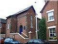
Tutbury Congregational Church
Situated in Monk Street
Image: © Geoff Pick
Taken: 20 Jul 2010
0.02 miles
2
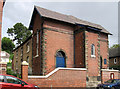
Tutbury - chapel on Monk Street
Originally an Ebenezer Methodist chapel. For an alternative view, please see Image
Image: © Dave Bevis
Taken: 3 Aug 2012
0.03 miles
3
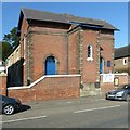
Ebenezer Congregational Church, Tutbury
The only remaining non-conformist place of worship in Tutbury. Part of the Congregational Federation which comprises churches which did not wish to join the United Reformed Church. The church opened in 1808, with later 19th century additions. The cross wing at the head of the church is an unusual form.
Image: © Alan Murray-Rust
Taken: 17 Oct 2017
0.03 miles
4
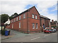
Monk Street, Tutbury
Ebenezer Congregational Church to the right.
Image: © Jonathan Thacker
Taken: 15 Aug 2019
0.04 miles
5
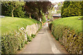
Church path
Sunken path from St.Mary's church to Church Street
Image: © Richard Croft
Taken: 22 May 2013
0.05 miles
6
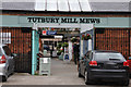
'Tutbury Mill Mews'
A relatively new retail development on the site of the Tutbury Mill.
Includes a mecca for model railway enthusiasts.
Image: © Brian Chadwick
Taken: 25 Sep 2012
0.06 miles
7
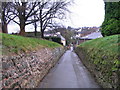
Sunken path
A path leading from St Mary's Priory Church down to the village.
Image: © M J Richardson
Taken: 8 Dec 2007
0.06 miles
8
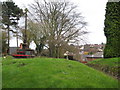
Churchyard view 3 - Tutbury, Staffordshire
Church and priory were begun in about 1086 by Henry de Ferrers. The Norman west doorway, including an arch of alabaster, the first one ever allegedly, is said to be one of the finest examples in England. The apse at the east end was constructed in 1868 to a design by G E Street (George Edmund) born 20th June 1824 at Woodford in Essex. This view of the war memorial is looking away from the church near the south door. Time taken 1.18 pm GMT (Greenwich Mean Time).
Image: © Martin Richard Phelan
Taken: 4 Dec 2011
0.06 miles
9
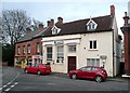
Lloyds Bank, Tutbury
A house has been converted to a bank by adding a façade in an early 20C version of Classical style, in amusing contrast to the cottagey dormers.
Image: © Humphrey Bolton
Taken: 7 Nov 2009
0.06 miles
10

Churchyard view 2 - Tutbury, Staffordshire
Church and priory were begun in about 1086 by Henry de Ferrers. The Norman west doorway, including an arch of alabaster, the first one ever allegedly, is said to be one of the finest examples in England. The apse at the east end was constructed in 1868 to a design by G E Street (George Edmund) born 20th June 1824 at Woodford in Essex. Time taken 12.45 pm GMT (Greenwich Mean Time).
Image: © Martin Richard Phelan
Taken: 4 Dec 2011
0.06 miles