IMAGES TAKEN NEAR TO
Bishop Lane, BURTON-ON-TRENT, DE13 9EY
Introduction
This page details the photographs taken nearby to Bishop Lane, DE13 9EY by members of the Geograph project.
The Geograph project started in 2005 with the aim of publishing, organising and preserving representative images for every square kilometre of Great Britain, Ireland and the Isle of Man.

There are currently over 7.5m images from over14,400 individuals and you can help contribute to the project by visiting https://www.geograph.org.uk
Image Map
Images are licensed for reuse under creativecommons.org/licenses/by-sa/2.0
Notes
- Clicking on the map will re-center to the selected point.
- The higher the marker number, the further away the image location is from the centre of the postcode.
Image Listing (10 Images Found)
Images are licensed for reuse under creativecommons.org/licenses/by-sa/2.0
Image
Details
Distance
1
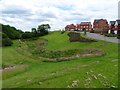
Balancing pond by King Road
Alleviation works have been required at the new Henhurst Fields development to reduce the risk of flooding of Shobnall Brook.
Image: © Ian Calderwood
Taken: 21 Jun 2019
0.09 miles
2
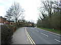
B5017 heading east
Towards Burton upon Trent.
Image: © JThomas
Taken: 19 Apr 2013
0.14 miles

5
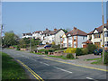
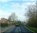
Classic tween-wars ribbon development
The B5017 is continuously ribbon-developed for about 2 miles between Shobnall and Rough Hay with these typical tween-wars semi-detached houses. This type of development led to more restrictive planning conditions after the second world war to prevent unnecessary encroachment on countryside.
Image: © Alan Murray-Rust
Taken: 15 Apr 2007
0.15 miles

7
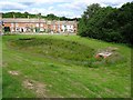
Balancing pond by Forest Road
Alleviation works have been required at the new Henhurst Fields development to reduce the risk of flooding of Shobnall Brook.
Image: © Ian Calderwood
Taken: 21 Jun 2019
0.21 miles
8

King Road
King Road is a new road leading to yet another housing development in the area around Burton on trent. The road is not marked on OS maps but will no doubt soon be put onto the map.
Image: © Malcolm Neal
Taken: 9 Aug 2018
0.22 miles
9
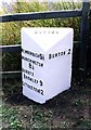
Old Milepost by the B5017, Forest Road, Branston parish
Cast iron post by the B5017, in parish of BRANSTON (EAST STAFFORDSHIRE District), Forest Road, near King Road new housing development, on the verge, on Southwest side of road. Lathe iron casting, erected by the County Council in the 19th/20th century.
Inscription reads:-
: NEWBOROUGH 5½ / MARCHINGTON / 8½ / ABBOTS - / BROMLEY 9 / UTTOXETER 12 : : BURTON : : BURTON 2 :
Maker:-
: Chas. Lathe, Tipton. :
Grade II listed.
List Entry Number: 1392732 https://historicengland.org.uk/listing/the-list/list-entry/1392732
Milestone Society National ID: ST_BTUT02.
Image: © J Higgins
Taken: 1 Jan 2000
0.23 miles