
IMAGES TAKEN NEAR TO
Beacon Drive, BURTON-ON-TRENT, DE13 9EL
Introduction
This page details the photographs taken nearby to Beacon Drive, DE13 9EL by members of the Geograph project.
The Geograph project started in 2005 with the aim of publishing, organising and preserving representative images for every square kilometre of Great Britain, Ireland and the Isle of Man.

There are currently over 7.5m images from over14,400 individuals and you can help contribute to the project by visiting https://www.geograph.org.uk
Image Map
Images are licensed for reuse under creativecommons.org/licenses/by-sa/2.0
Notes
- Clicking on the map will re-center to the selected point.
- The higher the marker number, the further away the image location is from the centre of the postcode.
Image Listing (26 Images Found)
Images are licensed for reuse under creativecommons.org/licenses/by-sa/2.0
Image
Details
Distance
1
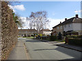
Elizabeth Avenue
The system built houses and the name date this road to around the time of accession of Queen Elizabeth II.
Image: © Alan Murray-Rust
Taken: 21 Feb 2014
0.13 miles
2

Rolleston Post Office
The village is large enough to have retained its Post Office following the cuts of recent years.
Image: © Alan Murray-Rust
Taken: 21 Feb 2014
0.16 miles
3
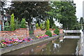
Rolleston-on-Dove, Staffordshire
Alms Houses fronted onto the River Dove
Image: © Brian Chadwick
Taken: 24 Aug 2009
0.17 miles
4

The Lawns, Rolleston on Dove
In the foreground the road crosses the Rolleston Brook; ahead is the village post office and the Co-op store.
Image: © Stephen McKay
Taken: 19 Oct 2013
0.17 miles
5

Brook Hollows Spinney
Originally part of the grounds of Rolleston Hall, now public recreation space.
Image: © Alan Murray-Rust
Taken: 21 Feb 2014
0.17 miles
6
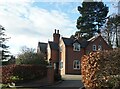
Kiln Lodge, Brick Kiln Lane Rolleston on Dove
Image: © Ian S
Taken: 15 Dec 2021
0.18 miles
7

14 & 16 Burnside
17th century timber-framed house, with later additions, now converted into two units. Listed Grade II and currently under refurbishment.
Image: © Alan Murray-Rust
Taken: 21 Feb 2014
0.21 miles
8

Rolleston Dam
Ornate dam and weir creating a fishpond for Rolleston Hall. Now public recreation space.
Image: © Alan Murray-Rust
Taken: 21 Feb 2014
0.21 miles
9

Rolleston - Along Burn Road
Viewed from the side of the 'Spread Eagle'
Image: © Brian Chadwick
Taken: 24 Aug 2009
0.21 miles
10

Pump at Rolleston Almshouses
Possibly late 18th or early 19th century. The mechanism is enclosed in an ornate timber box surround. Listed Grade II.
Image: © Alan Murray-Rust
Taken: 21 Feb 2014
0.22 miles