
IMAGES TAKEN NEAR TO
Castle Point Business Park, BURTON-ON-TRENT, DE13 9DX
Introduction
This page details the photographs taken nearby to Castle Point Business Park, DE13 9DX by members of the Geograph project.
The Geograph project started in 2005 with the aim of publishing, organising and preserving representative images for every square kilometre of Great Britain, Ireland and the Isle of Man.

There are currently over 7.5m images from over14,400 individuals and you can help contribute to the project by visiting https://www.geograph.org.uk
Image Map
Images are licensed for reuse under creativecommons.org/licenses/by-sa/2.0
Notes
- Clicking on the map will re-center to the selected point.
- The higher the marker number, the further away the image location is from the centre of the postcode.
Image Listing (12 Images Found)
Images are licensed for reuse under creativecommons.org/licenses/by-sa/2.0
Image
Details
Distance
1

Fauld Industrial Estate
Fauld industrial estate was once home to a Second World War munitions factory. The munitions were transported by rail (seen in the foreground) to the nearby mainline railway and also to storage in the nearby gypsum mine. http://www.carolyn.topmum.net/tutbury/fauld/fauldcrater.htm
Image: © Michael Patterson
Taken: 6 Mar 2006
0.13 miles

3
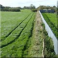
Converging parallels
Tractor run, footpath and fence. The footpath is one way up to the Stonepit Hills and the Fauld Crater https://www.geograph.org.uk/photo/1046097
Image: © Alan Murray-Rust
Taken: 17 Oct 2017
0.18 miles
4

Fauld Industrial Park entrance
Hidden from view is the small industrial park that this road runs towards.
Image: © Malcolm Neal
Taken: 9 Aug 2018
0.19 miles
5
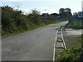
Railway tracks, Fauld
Part of the former RAF Fauld, now in use as an industrial estate. Remarkably, although the roadway has been resurfaced since David Stowell's 2009 view https://www.geograph.org.uk/photo/1224000 , the rails remain uncovered.
Image: © Alan Murray-Rust
Taken: 17 Oct 2017
0.20 miles
6

A Field of Kale on Fauld Lane
Behind the field is Fauld Industrial Estate.
Image: © Mick Malpass
Taken: 6 Nov 2011
0.20 miles

8

Footpath and Field near Fauld Industrial Park
Image: © Jonathan Clitheroe
Taken: 23 Mar 2020
0.23 miles
9

Track in former RAF Fauld
The remains of the 2' gauge railway which used to serve the former RAF Fauld. This was part of the munitions storage site which suffered the disastrous explosion (See Image ). The site continued in use until the 1970s and much of the rolling stock has found new homes in preserved and private railways around the country. This site is now the Fauld Industrial Estate.
Image: © David Stowell
Taken: 10 Mar 2009
0.23 miles
10

Track in former RAF Fauld
The remains of the 2' gauge railway which used to serve the former RAF Fauld. This was part of the munitions storage site which suffered the disastrous explosion (See Image ). The site continued in use until the 1970s and much of the rolling stock has found new homes in preserved and private railways around the country. This site is now the Fauld Industrial Estate.
Image: © David Stowell
Taken: 10 Mar 2009
0.23 miles