IMAGES TAKEN NEAR TO
Anslow Road, BURTON-ON-TRENT, DE13 8TX
Introduction
This page details the photographs taken nearby to Anslow Road, DE13 8TX by members of the Geograph project.
The Geograph project started in 2005 with the aim of publishing, organising and preserving representative images for every square kilometre of Great Britain, Ireland and the Isle of Man.

There are currently over 7.5m images from over14,400 individuals and you can help contribute to the project by visiting https://www.geograph.org.uk
Image Map
Images are licensed for reuse under creativecommons.org/licenses/by-sa/2.0
Notes
- Clicking on the map will re-center to the selected point.
- The higher the marker number, the further away the image location is from the centre of the postcode.
Image Listing (10 Images Found)
Images are licensed for reuse under creativecommons.org/licenses/by-sa/2.0
Image
Details
Distance
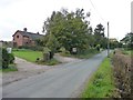
1
Farm under demolition
On the Hanbury to Anslow road
Image: © Oliver Dixon
Taken: 5 Jul 2006
0.05 miles
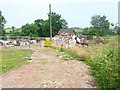
3
New House Rises from Demolition Site
When Oliver Dixon photographed this site in 2006, all that was here, was a pile of rubble and small barn. http://www.geograph.org.uk/photo/199004
Image: © Mick Malpass
Taken: 15 Sep 2011
0.07 miles
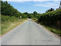
4
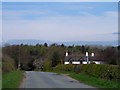
Near Blackbrook Farm
The road drops to Woodend
Image: © Bikeboy
Taken: 15 Apr 2015
0.10 miles
5
Footpath to Farm
A footpath runs across these fields to Lower Castle Hayes Farm in the next square east.
Image: © Michael Patterson
Taken: 6 Jul 2006
0.11 miles
6
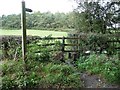
Footpath through a stream
On the north side of Anslow Road at Blackbrook.
Image: © Christine Johnstone
Taken: 9 Oct 2012
0.15 miles
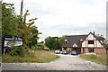
7
Logs for sale, house for sale, Anslow Road
Whichever your budget stretches to!
Image: © Christine Johnstone
Taken: 9 Oct 2012
0.16 miles
8
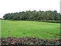
Blackbrook Spinney
Looking north from Anslow Road.
Image: © Christine Johnstone
Taken: 9 Oct 2012
0.17 miles
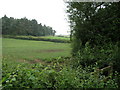
9
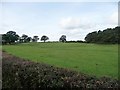
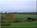
Contrasting trees in field and spinney
Farmland between Anslow Road and Blackbrook Spinney.
Image: © Christine Johnstone
Taken: 9 Oct 2012
0.23 miles