
IMAGES TAKEN NEAR TO
Lewis's Lane, BURTON-ON-TRENT, DE13 7JY
Introduction
This page details the photographs taken nearby to Lewis's Lane, DE13 7JY by members of the Geograph project.
The Geograph project started in 2005 with the aim of publishing, organising and preserving representative images for every square kilometre of Great Britain, Ireland and the Isle of Man.

There are currently over 7.5m images from over14,400 individuals and you can help contribute to the project by visiting https://www.geograph.org.uk
Image Map
Images are licensed for reuse under creativecommons.org/licenses/by-sa/2.0
Notes
- Clicking on the map will re-center to the selected point.
- The higher the marker number, the further away the image location is from the centre of the postcode.
Image Listing (76 Images Found)
Images are licensed for reuse under creativecommons.org/licenses/by-sa/2.0
Image
Details
Distance
1
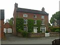
Manor Farmhouse, King's Bromley
Typical mid-18th century brick farmhouse, Listed Grade II.
Image: © Alan Murray-Rust
Taken: 6 Jun 2021
0.05 miles
2
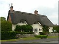
38 Manor Road, King's Bromley (Silver Thatch)
18th century colour-washed brick cottage with thatched roof, Listed Grade II.
Image: © Alan Murray-Rust
Taken: 6 Jun 2021
0.05 miles
3
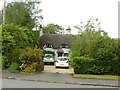
Manor Thatch, King's Bromley
Originally two cottages (Manor Thatch and Miller's Thatch) but now combined into a single dwelling. 18th century remodelling of an earlier building with cruck frames, Listed Grade II.
Image: © Alan Murray-Rust
Taken: 6 Jun 2021
0.06 miles
4

The War Memorial, King's Bromley
With the Royal Oak in the background.
Image: © Humphrey Bolton
Taken: 9 Nov 2009
0.10 miles
5

Alrewas Road, King's Bromley
The cottages on the left are listed, and are stated to be of the late 17C.
Image: © Humphrey Bolton
Taken: 9 Nov 2009
0.10 miles
6

Yoxall Road, King's Bromley
The cottages on the left are along Manor Road, and to quote from the description attached to another image on the site: "These date from 1860 and were funded by the Lane and Tomline families to house three poor men of the parish. The buildings carry the Lane armorial". The finger post is interesting in that the arms pointing north and south have lettering on a green background, as for a primary (trunk) route (ie the A515). This is normal on larger direction signs but seems unusual on a finger-post.
Image: © Humphrey Bolton
Taken: 9 Nov 2009
0.10 miles
7

King's Bromley
Staffordshire Village
Image: © www fotodiscs4u co uk
Taken: 8 Nov 2006
0.10 miles


