
IMAGES TAKEN NEAR TO
Kents Place, BURTON-ON-TRENT, DE13 7FH
Introduction
This page details the photographs taken nearby to Kents Place, DE13 7FH by members of the Geograph project.
The Geograph project started in 2005 with the aim of publishing, organising and preserving representative images for every square kilometre of Great Britain, Ireland and the Isle of Man.

There are currently over 7.5m images from over14,400 individuals and you can help contribute to the project by visiting https://www.geograph.org.uk
Image Map
Images are licensed for reuse under creativecommons.org/licenses/by-sa/2.0
Notes
- Clicking on the map will re-center to the selected point.
- The higher the marker number, the further away the image location is from the centre of the postcode.
Image Listing (251 Images Found)
Images are licensed for reuse under creativecommons.org/licenses/by-sa/2.0
Image
Details
Distance
1
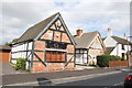
Timber Framed, Alrewas
Two superb timber framed buildings in main street Alrewas. One is tiled and the other has thatch.
Image: © Mick Malpass
Taken: 23 Sep 2011
0.03 miles
2
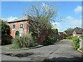
Scout Hall, Alrewas
A former Primitive Methodist chapel
Image: © Christine Johnstone
Taken: 7 May 2022
0.03 miles
3

69 Main Street, Alrewas
Originally a 17th century house, converted to office premises at one stage in the 20th, but now apparently back in residential use. It was given a Grade II listing https://www.britishlistedbuildings.co.uk/101374252-69-main-street-alrewas#.WiLlfdSLTGg in 1986.
Image: © Richard Law
Taken: 21 Nov 2017
0.03 miles
4

Timber Framed Buildings, Main Street. Alrewas
Image: © Mick Malpass
Taken: 23 Sep 2011
0.03 miles
5

The Tudor House (Hair & Beauty) in Alrewas
Originally a 17th century house, which was converted to shop premises in the late 20th century, and was Grade II listed https://www.britishlistedbuildings.co.uk/101295190-the-tudor-of-lichfield-alrewas#.WiLkSdSLTGg in 1986.
Image: © Richard Law
Taken: 21 Nov 2017
0.03 miles
6
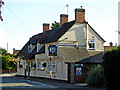
The William IV in Alrewas, Staffordshire
To avoid confusion, The William IV public house in Alrewas is located in William IV Road, which leads north from Main Street.
The William IV was three cottages until the 1830s, when it was converted into a pub.
Image: © Roger Kidd
Taken: 20 Jul 2016
0.03 miles
7
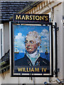
The William IV pub sign in Alrewas, Staffordshire
To avoid confusion, The William IV public house in Alrewas is located in William IV Road, which leads north from Main Street.
The William IV was three cottages until the 1830s, when it was converted into a pub.
Image]
Image: © Roger Kidd
Taken: 20 Jul 2016
0.03 miles
8
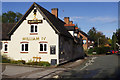
William IV, Alrewas
Marston's pub on William IV road, one of three in the village. Note the board under the windows spelling out 'welcome' in different languages.
Image: © Stephen McKay
Taken: 19 Oct 2016
0.03 miles
9
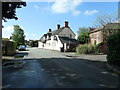
William IV Road, Alrewas
Named after the William IV pub. King William the Fourth ruled just before Queen Victoria, from 1830 to 1837. In 1900 this road was known as Old School Lane.
Image: © Christine Johnstone
Taken: 7 May 2022
0.04 miles
10
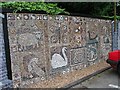
The Pebble Mosaic
On the rear wall of the Image car park with a notice stating, "A Community Art Project completed for the Alrewas Arts Festival 2006."
Image: © Andy Potter
Taken: 22 Aug 2007
0.04 miles