
IMAGES TAKEN NEAR TO
Main Street, SWADLINCOTE, DE12 6PZ
Introduction
This page details the photographs taken nearby to Main Street, DE12 6PZ by members of the Geograph project.
The Geograph project started in 2005 with the aim of publishing, organising and preserving representative images for every square kilometre of Great Britain, Ireland and the Isle of Man.

There are currently over 7.5m images from over14,400 individuals and you can help contribute to the project by visiting https://www.geograph.org.uk
Image Map
Images are licensed for reuse under creativecommons.org/licenses/by-sa/2.0
Notes
- Clicking on the map will re-center to the selected point.
- The higher the marker number, the further away the image location is from the centre of the postcode.
Image Listing (14 Images Found)
Images are licensed for reuse under creativecommons.org/licenses/by-sa/2.0
Image
Details
Distance
1
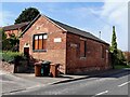
Linton Brick Room
The Brick Room is a community room belonging to Linton Church. It is used, amongst other things, for the meetings of Linton Parish Council.
Image: © Ian Calderwood
Taken: 7 Sep 2023
0.02 miles
2

Linton Village Hall
A modern village hall with facilities including an air-conditioned main hall with a stage, a kitchen, a dining area, a licensed bar and a garden.
Image: © Ian Calderwood
Taken: 7 Sep 2023
0.05 miles
3

Sign for the Red Lion, Linton
See Image] for context.
Image: © JThomas
Taken: 27 Jun 2019
0.09 miles

5
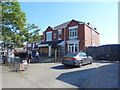
Post Office and shop on Main Street, Linton
Image: © JThomas
Taken: 27 Jun 2019
0.10 miles
6

Across the Fields to Linton
Looking across the fields to Linton village from Colliery Lane.
Image: © Sue Adair
Taken: 6 Sep 2005
0.11 miles
7
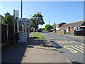
Bus stop and shelter on Main Street, Linton
Image: © JThomas
Taken: 27 Jun 2019
0.11 miles


10

Foxley Wood, Linton
Foxley Wood was purchased by the Woodland Trust on 17th November 1995. It extends to some 28.7ha and was previously two large arable fields. Local people were involved in the sites design and large numbers turned out to plant the first trees at a public event. One hectare in the far SW corner was retained for the exclusive design by Linton Primary School. They elected to have a surfaced path, restore the pond, build a mound with spoil later known as 'Linton Knob' and interestingly, plant quite a high proportion of mixed conifer trees when every child in the school came out to a dedicated tree planting day. A 'secret path' leads from school playing fields to the SE.
A permissive bridleway was included along the eastern boundary and a car park built at the Linton Heath end. Superb views can be had from the site over the Trent Valley to the Peak District beyond, from the site.
Image: © Sue Adair
Taken: 6 Sep 2005
0.13 miles