1
Overseal, St Matthew
Image: © Dave Kelly
Taken: 10 Jul 2020
0.07 miles
2
St Matthew's Church Overseal
Image: © john shepherd
Taken: 21 Nov 2006
0.07 miles
3
Overseal Parish Church and Public House
Church of Saint Matthew's and the Robin Hood public house situated at a crossroads in the centre of the village. The pub had just changed hands at the time of posting and a very friendly welcome was to be had inside.
Image: © Jonathan Clitheroe
Taken: 1 May 2011
0.09 miles
4
Sign for the Robin Hood public house, Overseal
Image: © JThomas
Taken: 27 Jun 2019
0.10 miles
5
Tyre King on Burton Road, Overseal
Image: © David Howard
Taken: 15 Aug 2021
0.11 miles
6
Old Milepost by the A444, Burton Road
Metal post with attached metal plate by the A444, in parish of OVERSEAL (SOUTH DERBYSHIRE District), Burton Road, by No. 6, in pavement, back to ornate brick retaining wall, on East side of road. Measham iron post, erected by the Burton on Trent to Market Bosworth turnpike trust in the 19th century.
Inscription reads:-
MILES
BURTON - 6
MEASHAM - 4
BOSWORTH - 12
Milestone Society National ID: DE_BTBW06.
Image: © J Scrine
Taken: 6 Oct 2012
0.11 miles
7
The Robin Hood public house, Overseal
On Burton Road.
Image: © JThomas
Taken: 27 Jun 2019
0.11 miles
8
Detail of ceramic wall and bug hotel, Overseal
The wall runs alongside a footpath near Daisy Lane in the former mining village of Overseal, now part of the National Forest.
Image: © A J Paxton
Taken: 14 Sep 2019
0.12 miles
9
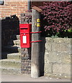
Elizabeth II postbox on Burton Road, Overseal
Postbox No. DE12 1199.
See
Image] for context.
Image: © JThomas
Taken: 27 Jun 2019
0.12 miles
10
Wall by footpath near Daisy Lane, Overseal
Mysterious wall made of large hollow bricks, each of which consists of nine ceramic tubes in a 3x3 formation. Possibly a giant 'bug hotel' connected with the (English?) National Forest.
Image: © A J Paxton
Taken: 14 Sep 2019
0.12 miles


