
IMAGES TAKEN NEAR TO
Crompton Street, DERBY, DE1 1NX
Introduction
This page details the photographs taken nearby to Crompton Street, DE1 1NX by members of the Geograph project.
The Geograph project started in 2005 with the aim of publishing, organising and preserving representative images for every square kilometre of Great Britain, Ireland and the Isle of Man.

There are currently over 7.5m images from over14,400 individuals and you can help contribute to the project by visiting https://www.geograph.org.uk
Image Map
Images are licensed for reuse under creativecommons.org/licenses/by-sa/2.0
Notes
- Clicking on the map will re-center to the selected point.
- The higher the marker number, the further away the image location is from the centre of the postcode.
Image Listing (423 Images Found)
Images are licensed for reuse under creativecommons.org/licenses/by-sa/2.0
Image
Details
Distance
1
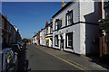
The Crompton Tavern
This is a family run pub with a pleasant garden at the rear.
Image: © Malcolm Neal
Taken: 14 Sep 2019
0.01 miles
3

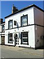
Laurie House, Colyear Street, Derby
One of the city's larger 1960s/1970s developments. L-shaped brick and concrete ranges. The entrance looks to be clad in black marble.
Apparently housing offices, car park, hotel and nightclub, and probably awaiting an overhaul.
Image: © Stephen Richards
Taken: 20 Jun 2012
0.05 miles
4
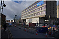
Demolition in progress
The old Penine Hotel is being knocked down, though the demolition is not as far on as I thought it would be.
Image: © Malcolm Neal
Taken: 22 Feb 2022
0.05 miles
5
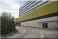
About to be demolished
This building which housed the Bowling alley and also the dance venue the Pink Coconut, renamed many times and closed about ten years ago, is due for demolition in a couple of weeks when it will follow the Pennine Hotel into oblivion.
Image: © Malcolm Neal
Taken: 5 Apr 2022
0.07 miles
6

The Eye Sore in Derby City Centre
This image is of the still undeveloped area near the centre of Derby, formerly Known as Duckworth Square. Originally, back in the 1950's it was a warren of small very old streets but had a cinema "The Black Prince" on one edge. The whole area was demolished and replaced with Duckworth Square Shopping Centre, still with a cinema. This eventually all fell into disuse and was again demolished, possibly as long ago as 20 or 30 years and this hole in the ground has remained ever since.
Image: © Malcolm Neal
Taken: 18 Mar 2017
0.07 miles
7
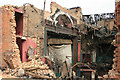
The Derby Hippodrome
A developer bought this listed, but defunct theatre, and then started to tear down the roof of the old auditiorium only to be stopped by a court order. Since then the building has slowly rotted away. The council not having any money or the will to do anything for the building. The Hippodrome trust has ideas of restoring the building back to a working theatre, but Derby does not support the one theatre we have left to really justify that outcome.
Image: © Malcolm Neal
Taken: 10 May 2008
0.07 miles
8
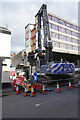
Demolition in progress
This end of the old Penine Hotel has already disappeared.
Image: © Malcolm Neal
Taken: 22 Feb 2022
0.07 miles
9

Gerard Street North
Until the inner ring road was completed Gerard Street was a continuous street of houses. After the ring road appeared Gerard Street was split and renamed as two different streets, Gerard Street North and Gerard Street.
Image: © Malcolm Neal
Taken: 25 Feb 2020
0.08 miles
10

Derelict land, Colyear Street, Derby
Broadly oblong, bounded by Colyear Street, Macklin Street and Becketwell Lane. Very central so prime building land one would have thought.
Image: © Stephen Richards
Taken: 20 Jun 2012
0.08 miles