
IMAGES TAKEN NEAR TO
Leake Street, DERBY, DE1 1GQ
Introduction
This page details the photographs taken nearby to Leake Street, DE1 1GQ by members of the Geograph project.
The Geograph project started in 2005 with the aim of publishing, organising and preserving representative images for every square kilometre of Great Britain, Ireland and the Isle of Man.

There are currently over 7.5m images from over14,400 individuals and you can help contribute to the project by visiting https://www.geograph.org.uk
Image Map
Images are licensed for reuse under creativecommons.org/licenses/by-sa/2.0
Notes
- Clicking on the map will re-center to the selected point.
- The higher the marker number, the further away the image location is from the centre of the postcode.
Image Listing (126 Images Found)
Images are licensed for reuse under creativecommons.org/licenses/by-sa/2.0
Image
Details
Distance
1
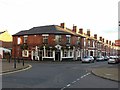
The Crescent, Campion Street, Derby
Classic corner pub in late 19th century terraced housing development, the frontage showing commendably little alteration.
Image: © Alan Murray-Rust
Taken: 5 Nov 2017
0.03 miles
2
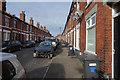
Wild Street
Wild Street is a street of mainly older terraced houses with no garage space so on street parking is necessary. The car just ahead has obviously been in an accident as it is missing its front bumper and possibly other parts as well.
Image: © Malcolm Neal
Taken: 22 Oct 2019
0.04 miles
3
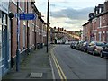
Cycle route fingerpost, Campion Street, Derby
Not the most likely surroundings for a National Cycle Route, but it keeps cyclists away from busy main roads. Route 54 links Stourport with Parsley Hay (near Buxton). Route 68 uses route 54 from Derby before starting its own life at Etwall, running the length of the Pennines to terminate at Berwick-upon-Tweed.
Image: © Alan Murray-Rust
Taken: 5 Nov 2017
0.05 miles
4
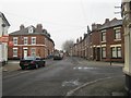
Campion Street, Derby
Looking up Campion Street with Stables Street to the left (Osmaston Fish and Chip Shop) and Wild Street to the right (The Crescent Pub).
Image: © Eamon Curry
Taken: 5 Jan 2010
0.05 miles
5
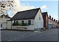
The Lonny Wilsoncroft Community Centre, Campion Street, Derby
Formerly a Primitive Methodist Chapel, now run by the New Zealand Community Association. The link with the antipodes is somewhat stretched; the district is named New Zealand after the farm which preceded it, the farm being named to commemorate the Treaty of Waitangi of 1840.
Image: © Alan Murray-Rust
Taken: 5 Nov 2017
0.06 miles
6
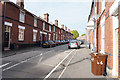
Stepping Lane
A narrow old lane with terraced houses, all of which appear to have at least one car and many are part parked on the pavement to allow space for emergency service vehicles to pass along the road if they are needed.
Image: © Malcolm Neal
Taken: 22 Oct 2019
0.07 miles
7
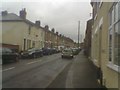
Campion Street, Derby
The greatest street in Derby.
Image: © Eamon Curry
Taken: 30 Jun 2007
0.07 miles
8
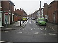
Wild Street, Derby
Looking up Wild Street from its junction with Uttoxeter Old Road in Derby.
Image: © Eamon Curry
Taken: 5 Jan 2010
0.07 miles
9
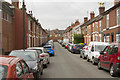
Etwall St. Derby
This narrow terraced street is not a cul de sac. It has a left hand turn at the end down to Slack Lane. Parking, however, must be a real problem!
Image: © Malcolm Neal
Taken: 6 Apr 2017
0.07 miles
10
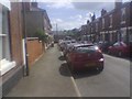
Findern Street, Derby
Looking down Findern Street from Etwall Street to see Slack Lane at the bottom of the street.
Image: © Eamon Curry
Taken: 7 Jul 2007
0.07 miles