
IMAGES TAKEN NEAR TO
Brick Street, DERBY, DE1 1DU
Introduction
This page details the photographs taken nearby to Brick Street, DE1 1DU by members of the Geograph project.
The Geograph project started in 2005 with the aim of publishing, organising and preserving representative images for every square kilometre of Great Britain, Ireland and the Isle of Man.

There are currently over 7.5m images from over14,400 individuals and you can help contribute to the project by visiting https://www.geograph.org.uk
Image Map
Images are licensed for reuse under creativecommons.org/licenses/by-sa/2.0
Notes
- Clicking on the map will re-center to the selected point.
- The higher the marker number, the further away the image location is from the centre of the postcode.
Image Listing (278 Images Found)
Images are licensed for reuse under creativecommons.org/licenses/by-sa/2.0
Image
Details
Distance
1

Friargate, Ashbourne Road and Brick Street, Derby
This is where Friargate and Ashbourne Road meet each other. Brick Street is the road on the right.
Image: © Eamon Curry
Taken: 7 Jul 2007
0.01 miles
2

The Brick & Tile
Public house on the corner of Brick Street and Markeaton Street. This is believed to have been an inn since being built circa 1690.
Image: © J147
Taken: 23 Sep 2007
0.01 miles


5

Headless Cross, Friar Gate-Brick Street, Derby
Originally formed as a medieval cross which was used by local Derby people during the plague supposedly around 1665 although there are arguments about this. During the plague people from outside the town would deposit there goods for sale nearby the stone and any money from local Derby people was deposited into a bowl of vinegar on top of the stone with the idea being that the vinegar would disinfect the money thus killing off the plague from the money and the outside people could collect the uninfected money.
Image: © Eamon Curry
Taken: 22 Oct 2007
0.02 miles
6
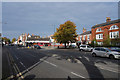
Friar Gate
This is where Friar Gate become the Ashbourne Road at a point just beyond the autumnal tree to the right of centre.
Image: © Malcolm Neal
Taken: 22 Oct 2019
0.02 miles
7

The Headless Cross - Friar Gate, Derby
The interesting story of the Headless Cross is told by Maxwell Craven at:
http://www.youandyesterday.co.uk/articles/The_true_history_of_Friar_Gate's_Headless_Cross
Image: © J147
Taken: 13 Oct 2007
0.03 miles
8

The Headless Cross Friargate
The Headless Cross in Friar Gate, Derby - A Grade II Listed Ancient Monument at the heart of a busy thoroughfare is a medieval preaching cross. Unobtrusive, indeed easily missed, it renders itself immediately mysterious for what it lacks. The base lost its cross at least six centuries ago – hence its contradictory title ‘The Headless Cross’.
Image: © Malcolm Neal
Taken: 29 Oct 2019
0.03 miles
9
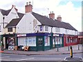
The Old White Lion Inn
This betting shop was once an inn on the cattle market, which was held here until the mid-19th century. Records of it exist from at least 1732. When the cattle market closed, the inn declined and was converted into shops.
Image: © Ian Calderwood
Taken: 12 May 2012
0.03 miles
10
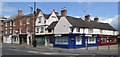
Derby - Ashbourne Road - junction with Brick Street
The shops on Brick Street (Nos 11 & 13) and Ashbourne Road (Nos 2/4/4A) are listed Grade II - see http://www.britishlistedbuildings.co.uk/en-400313-2-ashbourne-road-see-details-for-further#.VaJgESFwZtM and http://www.heritagegateway.org.uk/Gateway/Results_Single.aspx?uid=MDR10680&resourceID=1023 .
Image: © Dave Bevis
Taken: 11 Jul 2015
0.03 miles