IMAGES TAKEN NEAR TO
Bass's Crescent, SWADLINCOTE, DE11 9HN
Introduction
This page details the photographs taken nearby to Bass's Crescent, DE11 9HN by members of the Geograph project.
The Geograph project started in 2005 with the aim of publishing, organising and preserving representative images for every square kilometre of Great Britain, Ireland and the Isle of Man.

There are currently over 7.5m images from over14,400 individuals and you can help contribute to the project by visiting https://www.geograph.org.uk
Image Map
Images are licensed for reuse under creativecommons.org/licenses/by-sa/2.0
Notes
- Clicking on the map will re-center to the selected point.
- The higher the marker number, the further away the image location is from the centre of the postcode.
Image Listing (10 Images Found)
Images are licensed for reuse under creativecommons.org/licenses/by-sa/2.0
Image
Details
Distance
1

George VI postbox on Linton Road, Castle Gresley
Outside the former Post Office.
Postbox No. DE11 1119.
See Image] for context.
Image: © JThomas
Taken: 27 Jun 2019
0.11 miles
2

Village Stores on Linton Road, Castle Gresley
The former Post Office.
Showing position of Postbox No. DE11 1119.
See Image] for postbox.
Image: © JThomas
Taken: 27 Jun 2019
0.11 miles
3

Houses in Castle Gresley
Castle Gresley is another former mining village / town in this part of the world. The mine has long since been closed and the area was quite depressed but now seems to be recovering a little.
Image: © Malcolm Neal
Taken: 11 Oct 2017
0.12 miles
4

Castle Gresley Post Office
Castle Gresley Post Office in Linton Road.
Image: © Sue Adair
Taken: 4 Sep 2005
0.13 miles
5
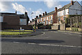
Linton Road
Linton Road is on the edge of Mount Pleasant and Castle Gresley. There are several Gresleys close by and all are on the edge of Swadlincote.
Image: © Malcolm Neal
Taken: 15 Feb 2018
0.16 miles
6
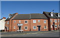
Houses on Mount Pleasant Road, Castle Gresley
Image: © JThomas
Taken: 27 Jun 2019
0.17 miles
7
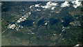
Swadlincote from the air
As seen from a Luton bound flight from Glasgow.
Image: © Thomas Nugent
Taken: 17 Apr 2024
0.17 miles
8
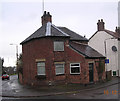
High Cross Bank Tollhouse by the A444, Burton Road
Tollhouse by the A444, in the parish of Castle Gresley (South Derbyshire District), Old Toll House, Burton Road, DE11.
Derbyshire HER.
HER No.: 17814 https://www.heritagegateway.org.uk/Gateway/Results_Single.aspx?uid=MDR11151&resourceID=1023
Surveyed
Milestone Society National ID: DE.CAG
Image: © Alan Rosevear
Taken: 15 Dec 2004
0.19 miles
9
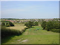
Children's playground, Castle Gresley
Children's playground in field from Mount Pleasant Road, Castle Gresley looking towards Church Gresley in the distance
Image: © Sue Adair
Taken: 4 Sep 2005
0.22 miles