IMAGES TAKEN NEAR TO
BRECHIN, DD9 7PY
Introduction
This page details the photographs taken nearby to DD9 7PY by members of the Geograph project.
The Geograph project started in 2005 with the aim of publishing, organising and preserving representative images for every square kilometre of Great Britain, Ireland and the Isle of Man.

There are currently over 7.5m images from over14,400 individuals and you can help contribute to the project by visiting https://www.geograph.org.uk
Image Map
Images are licensed for reuse under creativecommons.org/licenses/by-sa/2.0
Notes
- Clicking on the map will re-center to the selected point.
- The higher the marker number, the further away the image location is from the centre of the postcode.
Image Listing (11 Images Found)
Images are licensed for reuse under creativecommons.org/licenses/by-sa/2.0
Image
Details
Distance
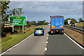
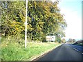
4
Car approaching a junction at Keithock
Image: © Mike Pennington
Taken: 2 Jun 2017
0.14 miles
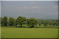
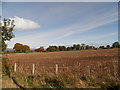
5
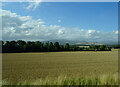
Cereal crop towards woodland, East Mains of Keithcock
Image: © JThomas
Taken: 20 Aug 2020
0.18 miles
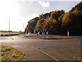
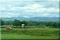
8
Approach to Keithock roundabout
On B966 out of Brechin.
Image: © Stanley Howe
Taken: 27 Oct 2011
0.19 miles
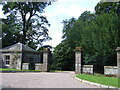
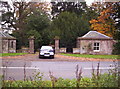
9
Keithock House Entrance
The entrance to Keithock House off the B966.
Image: © Scott Cormie
Taken: 16 Sep 2018
0.20 miles
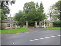
10
Gatehouse to Keithock
Image: © Dominic Dawn Harry and Jacob Paterson
Taken: 15 Oct 2005
0.22 miles