IMAGES TAKEN NEAR TO
BRECHIN, DD9 7PQ
Introduction
This page details the photographs taken nearby to DD9 7PQ by members of the Geograph project.
The Geograph project started in 2005 with the aim of publishing, organising and preserving representative images for every square kilometre of Great Britain, Ireland and the Isle of Man.

There are currently over 7.5m images from over14,400 individuals and you can help contribute to the project by visiting https://www.geograph.org.uk
Image Map
Images are licensed for reuse under creativecommons.org/licenses/by-sa/2.0
Notes
- Clicking on the map will re-center to the selected point.
- The higher the marker number, the further away the image location is from the centre of the postcode.
Image Listing (11 Images Found)
Images are licensed for reuse under creativecommons.org/licenses/by-sa/2.0
Image
Details
Distance
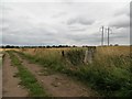
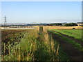
4
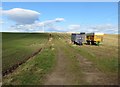
Fields near East Pitforthie separated by a farm track
Looking northward. Also visible is a turbine producing and pylons transporting electricity
Image: © Peter Wood
Taken: 20 Oct 2018
0.12 miles
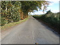
5
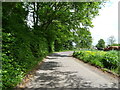
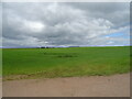
Minor road, East Pitforthie
Towards Leightonhill.
Image: © JThomas
Taken: 11 Jun 2021
0.15 miles
6
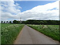
Minor road, East Pitforthie
Towards Leightonhill.
Image: © JThomas
Taken: 11 Jun 2021
0.16 miles
8
Trig point beside a farm track at Mains of Pitforthie
Image: © John Ferguson
Taken: 1 Aug 2018
0.19 miles
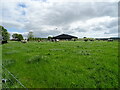
9
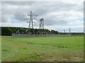
Pitforthie Trig Pillar
Looking south to the triangulation pillar near East Pitforthie, with the electricity sub-station beyond to the left.
Image: © Scott Cormie
Taken: 19 Aug 2022
0.19 miles
10
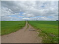
Minor road heading towards East Pitforthie
Looking north-eastward.
Image: © Peter Wood
Taken: 20 Oct 2018
0.22 miles