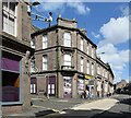
IMAGES TAKEN NEAR TO
Maison Dieu Lane, BRECHIN, DD9 6JA

Introduction

This page details the photographs taken nearby to Maison Dieu Lane, DD9 6JA by members of the Geograph project.

The Geograph project started in 2005 with the aim of publishing, organising and preserving representative images for every square kilometre of Great Britain, Ireland and the Isle of Man.

There are currently over 7.5m images from over14,400 individuals and you can help contribute to the project by visiting https://www.geograph.org.uk

Image Map


Images are licensed for reuse under creativecommons.org/licenses/by-sa/2.0
Notes
  • Clicking on the map will re-center to the selected point.
  • The higher the marker number, the further away the image location is from the centre of the postcode.

Image Listing (143 Images Found)

Images are licensed for reuse under creativecommons.org/licenses/by-sa/2.0
  • ...
Image
Details
Distance
1
Market Street, Brechin, near its junction with Maisondieu Lane
Image: © Alan Morrison Taken: 10 Feb 2010
0.03 miles
2
Market Street, Brechin
Image: © Richard Webb Taken: 23 Jan 2016
0.03 miles
3
Maison Dieu
Maison Dieu (House of God) was a medieval hospital founded by William de Brechin. It was not a hospital in the modern sense where people were looked after when sick, but it was a place to give shelter to poor or old people who could no longer look after themselves. It housed a master and chaplains who prayed for the soul of the founder as well as the poor folk it sheltered.
Image: © Karen Vernon Taken: 20 Jul 2008
0.04 miles
4
Savoy, Brechin
Market Street, Brechin.
Image: © Richard Webb Taken: 23 Jan 2016
0.04 miles
5
Allan's TV Service
Brechin is a good place for a wee bit of short range time travel. Market Street.
Image: © Richard Webb Taken: 23 Jan 2016
0.05 miles
6
Corner of Swan Street and Market Street, Brechin
The corner block is B-listed (LB22579 https://portal.historicenvironment.scot/designation/LB22579 ) but looking a bit run down. Note the tiny sign to 'Timmer Market' to the left of the splayed corner elevation.
Image: © Bill Harrison Taken: 11 Aug 2023
0.05 miles
7
St Andrew Street, Brechin
A traffic calmed area, seen from Airlie Street.
Image: © Stanley Howe Taken: 27 Oct 2011
0.05 miles
8
City Hall, Brechin
9 Swan Street.
Image: © Stanley Howe Taken: 27 Oct 2011
0.06 miles
9
Looking east along Brechin High Street
From the Airlie Street junction.
Image: © Stanley Howe Taken: 27 Oct 2011
0.06 miles
10
Brechin Arms pub
Town centre pub on St David's Street.
Image: © Gordon Hatton Taken: 16 Sep 2021
0.06 miles
  • ...