1
Little Tin Church, Brechin
Apparently known locally as the Little Tin Church, this building, made of corrugated Iron, faces east into Commerce Street.
Image: © Alan Morrison
Taken: 2 Feb 2008
0.02 miles
2
Brechin - Flat Renovations in Bridge Street
External insulation is being installed to improve the flats and reduce energy wastage and environmental damage.
Image: © James Emmans
Taken: 15 Sep 2016
0.06 miles
3
Brechin - Close Up of External Insulation Boards
The insulation is being fixed without interruption to flat occupants.
http://www.geograph.org.uk/photo/5208925
Image: © James Emmans
Taken: 15 Sep 2016
0.06 miles
4
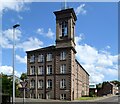
View of the Old Denburn Works from Union Street
The Works were built in 1854 and the site was redeveloped into mixed use by Hillcrest in 1992. The mill and Italianate bell tower are listed.
Image: © James Emmans
Taken: 15 Sep 2016
0.06 miles
5
Flats on Montrose Street (A935), Brechin
Formerly the Denburn Works.
Image: © Stanley Howe
Taken: 11 Jul 2015
0.07 miles
6
Back Braes, Brechin
Image: © Richard Webb
Taken: 11 Nov 2015
0.07 miles
7
Former Den Burn Works, Brechin
The B-listed (LB22513 https://portal.historicenvironment.scot/designation/LB22513 ) linen mill dates from 1864 and is now nicely converted into flats.
Image: © Bill Harrison
Taken: 11 Aug 2023
0.07 miles
8
111-115 High Street, Brechin
The ashlar B-listed building (LB22489 https://portal.historicenvironment.scot/designation/LB22489 ) seems to be falling into dereliction with crumbling stonework and boarded-up windows. The building to the left is also listed (LB22488 https://portal.historicenvironment.scot/designation/LB22488 ).
Image: © Bill Harrison
Taken: 11 Aug 2023
0.07 miles
9
Tin tabernacle, South Esk Street
An iron building in Brechin, home to many decaying architectural delights.
Image: © Richard Webb
Taken: 23 Jan 2016
0.08 miles
10
South Esk Street, Brechin
Image: © Alan Morrison
Taken: 30 Nov 2008
0.09 miles


