IMAGES TAKEN NEAR TO
Orchard Brae, KIRRIEMUIR, DD8 4JY

Introduction

This page details the photographs taken nearby to Orchard Brae, DD8 4JY by members of the Geograph project.

The Geograph project started in 2005 with the aim of publishing, organising and preserving representative images for every square kilometre of Great Britain, Ireland and the Isle of Man.

There are currently over 7.5m images from over14,400 individuals and you can help contribute to the project by visiting https://www.geograph.org.uk

Image Map


Images are licensed for reuse under creativecommons.org/licenses/by-sa/2.0
Notes
  • Clicking on the map will re-center to the selected point.
  • The higher the marker number, the further away the image location is from the centre of the postcode.

Image Listing (7 Images Found)

Images are licensed for reuse under creativecommons.org/licenses/by-sa/2.0
Image
Details
Distance
1
Glengate
Aptly named as you would leave this way for Glen Prosen and Glen Clova from the town centre.
Image: © Richard Webb Taken: 29 Mar 2015
0.10 miles
2
House above Kirriemuir Den
The monkey puzzle tree has a chicken house built around the trunk.
Image: © Mike Pennington Taken: 19 Jul 2011
0.14 miles
3
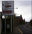
Signpost in Kirriemuir
This is in Glengate, Kirriemuir and depicts the road routes to Alyth, Blairgowrie, Cortachy and The Glens.
Image: © Alan Morrison Taken: 16 Mar 2007
0.14 miles
4
The Den, Kirriemuir
A recreation area in the valley of the Gairie Burn in the centre of Kirriemuir.
Image: © Mike Pennington Taken: 1 Apr 2009
0.19 miles
5
Lord Lyell Drive
New houses in Kirriemuir.
Image: © Richard Webb Taken: 16 Sep 2015
0.20 miles
6
Head of Kirriemuir Den
The Gairie Burn flows through the den.
Image: © Mike Pennington Taken: 19 Jul 2011
0.23 miles
7
Masonic Lodge, Kirriemuir
Lodge Airlie No.286, Kirriemuir, Angus, Scotland.
Image: © Jim Campbell Taken: 30 May 2012
0.24 miles