
IMAGES TAKEN NEAR TO
FORFAR, DD8 3TJ
Introduction
This page details the photographs taken nearby to DD8 3TJ by members of the Geograph project.
The Geograph project started in 2005 with the aim of publishing, organising and preserving representative images for every square kilometre of Great Britain, Ireland and the Isle of Man.

There are currently over 7.5m images from over14,400 individuals and you can help contribute to the project by visiting https://www.geograph.org.uk
Image Map
Images are licensed for reuse under creativecommons.org/licenses/by-sa/2.0
Notes
- Clicking on the map will re-center to the selected point.
- The higher the marker number, the further away the image location is from the centre of the postcode.
Image Listing (5 Images Found)
Images are licensed for reuse under creativecommons.org/licenses/by-sa/2.0
Image
Details
Distance
1
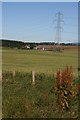
Bogside
The buildings of the farm are dwarfed by the electricity pylon. The crop is oats.
Image: © Anne Burgess
Taken: 8 Aug 2007
0.01 miles
2
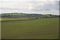
Bogside near Forfar
Forfar in the background.
Image: © Mike Pennington
Taken: 8 Jun 2015
0.05 miles
3
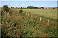
Carse
The rough vegetation marks the course of the burn - really just a ditch - which drains the land here. The farm is Bogside, and the crop in the intervening field is oats.
Image: © Anne Burgess
Taken: 8 Aug 2007
0.06 miles
4
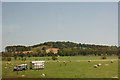
Land Rover in a field of sheep at Bogside, near Forfar
Carse Hill is in the background.
Image: © Mike Pennington
Taken: 3 Jun 2011
0.18 miles
5
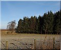
Shrunken field.
Small triangular field beside a small wood. It would have been bigger once, only the Forfar by-pass runs through it.
Image: © Richard Webb
Taken: 18 Feb 2007
0.25 miles