IMAGES TAKEN NEAR TO
Fern, FORFAR, DD8 3RB
Introduction
This page details the photographs taken nearby to DD8 3RB by members of the Geograph project.
The Geograph project started in 2005 with the aim of publishing, organising and preserving representative images for every square kilometre of Great Britain, Ireland and the Isle of Man.

There are currently over 7.5m images from over14,400 individuals and you can help contribute to the project by visiting https://www.geograph.org.uk
Image Map
Images are licensed for reuse under creativecommons.org/licenses/by-sa/2.0
Notes
- Clicking on the map will re-center to the selected point.
- The higher the marker number, the further away the image location is from the centre of the postcode.
Image Listing (12 Images Found)
Images are licensed for reuse under creativecommons.org/licenses/by-sa/2.0
Image
Details
Distance

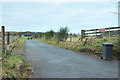
2
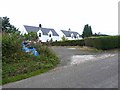
Courtford Park
Two blocks of semis at Noranside.
Image: © Oliver Dixon
Taken: 9 Aug 2013
0.01 miles
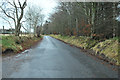
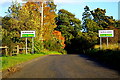
3

Courtford Bridge
Minor road over Noran Water.
Image: © Stanley Howe
Taken: 28 Jul 2016
0.05 miles
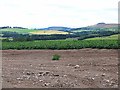
5
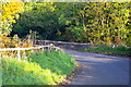
Courtford Bridge, Noranside
The River Noran flows under this bridge.
Image: © Alan Morrison
Taken: 15 Oct 2008
0.08 miles
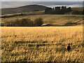
6

Noranside Cottages
Council Houses by minor road from Fern.
Image: © Stanley Howe
Taken: 28 Jul 2016
0.15 miles