
IMAGES TAKEN NEAR TO
Canmore Street, FORFAR, DD8 3HT
Introduction
This page details the photographs taken nearby to Canmore Street, DD8 3HT by members of the Geograph project.
The Geograph project started in 2005 with the aim of publishing, organising and preserving representative images for every square kilometre of Great Britain, Ireland and the Isle of Man.

There are currently over 7.5m images from over14,400 individuals and you can help contribute to the project by visiting https://www.geograph.org.uk
Image Map
Images are licensed for reuse under creativecommons.org/licenses/by-sa/2.0
Notes
- Clicking on the map will re-center to the selected point.
- The higher the marker number, the further away the image location is from the centre of the postcode.
Image Listing (210 Images Found)
Images are licensed for reuse under creativecommons.org/licenses/by-sa/2.0
Image
Details
Distance
1
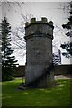
Castle Hill
Site of Forfar Castle. Nothing of the original castle remains. To get into the site you have to go to a little shop and leave a one pound deposit, you are then given the key for a gate.
Image: © Mary Rodgers
Taken: 6 Apr 2017
0.04 miles
2
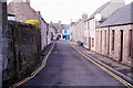
Canmore Street, Forfar
Photo taken from Canmore Street where the road bends southwards. The street that can be seen at the far end of the picture is Castle Street.
Image: © Alan Morrison
Taken: 17 Feb 2009
0.05 miles
3
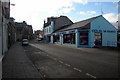
Castle Street, Forfar near its junction with Victoria Street
Picture taken from near Victoria Street,looking south.
Image: © Alan Morrison
Taken: 9 Feb 2010
0.05 miles
4
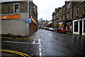
Castle Street, Forfar
Picture taken from its junction with Canmore Street, looking south.
Image: © Alan Morrison
Taken: 3 Mar 2009
0.05 miles
5
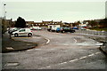
Greens Carpark, Forfar
Photo taken from east entrance at Green Street and Wellbraehead junction.
Image: © Alan Morrison
Taken: 15 Feb 2009
0.05 miles
6
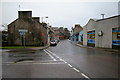
View of Castle Street, Forfar at its junction with Victoria Street
Image: © Alan Morrison
Taken: 3 Mar 2009
0.05 miles
7
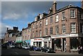
Castle Street
The main shopping streets of Forfar still have some independents among the chain stores. The buildings along the street here are mostly Georgian.
Image: © Anne Burgess
Taken: 17 Apr 2007
0.06 miles
8
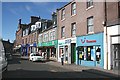
Castle Street
This is one of the main streets of Forfar, and still follows the mediaeval layout. It was formerly known as Spout Street. The town still has a range of locally owned independent shops, despite the best efforts of the chains, charity shops and supermarkets to kill it off.
Image: © Anne Burgess
Taken: 13 Aug 2010
0.06 miles
9
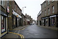
Castle Street, Forfar
Picture taken from near its junction with Manor Street, looking north.
Image: © Alan Morrison
Taken: 11 Mar 2009
0.06 miles
10
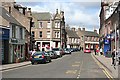
Castle Street
This is one of the main streets of Forfar, the others being East and West High Streets. It links the Cross with the alleged site of King Malcolm Canmore's castle, which stands on a small hill to the east of Castle Street. The old name of Castle Street was Spout Street.
Image: © Anne Burgess
Taken: 17 Apr 2007
0.06 miles