IMAGES TAKEN NEAR TO
FORFAR, DD8 2UY
Introduction
This page details the photographs taken nearby to DD8 2UY by members of the Geograph project.
The Geograph project started in 2005 with the aim of publishing, organising and preserving representative images for every square kilometre of Great Britain, Ireland and the Isle of Man.

There are currently over 7.5m images from over14,400 individuals and you can help contribute to the project by visiting https://www.geograph.org.uk
Image Map
Images are licensed for reuse under creativecommons.org/licenses/by-sa/2.0
Notes
- Clicking on the map will re-center to the selected point.
- The higher the marker number, the further away the image location is from the centre of the postcode.
Image Listing (8 Images Found)
Images are licensed for reuse under creativecommons.org/licenses/by-sa/2.0
Image
Details
Distance
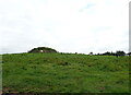
4
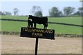
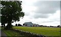
Tulliwhanland Farm
I couldn't find much about the farm however in a 1939 Directory I was able to find out that George Easton was the owner of the farm.
https://www.electricscotland.com/History/forfar/direct/forfardir1939.pdf
Image: © Mary Rodgers
Taken: 18 Sep 2020
0.08 miles
5
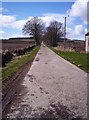
Track to Tilliwhandland
Image: © Dominic Dawn Harry and Jacob Paterson
Taken: 8 Apr 2006
0.08 miles
7
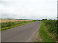
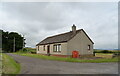
Minor road near Craiksfolds
Towards Aberlemno.
Image: © JThomas
Taken: 20 Jul 2021
0.13 miles
8
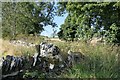
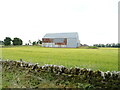
Drystone Wall
Drystone wall near Craiksfold farm. There is a path the leads to marshy grounds that runs long the wall.
Image: © Mary Rodgers
Taken: 18 Sep 2020
0.18 miles