
IMAGES TAKEN NEAR TO
Osprey Gardens, FORFAR, DD8 2UU
Introduction
This page details the photographs taken nearby to Osprey Gardens, DD8 2UU by members of the Geograph project.
The Geograph project started in 2005 with the aim of publishing, organising and preserving representative images for every square kilometre of Great Britain, Ireland and the Isle of Man.

There are currently over 7.5m images from over14,400 individuals and you can help contribute to the project by visiting https://www.geograph.org.uk
Image Map
Images are licensed for reuse under creativecommons.org/licenses/by-sa/2.0
Notes
- Clicking on the map will re-center to the selected point.
- The higher the marker number, the further away the image location is from the centre of the postcode.
Image Listing (20 Images Found)
Images are licensed for reuse under creativecommons.org/licenses/by-sa/2.0
Image
Details
Distance
1
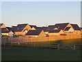
New houses, Forfar
A lot of houses are currently being built north of Montrose Road. These are an earlier phase and are recently completed.
Image: © Richard Webb
Taken: 11 Jan 2014
0.08 miles
2
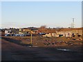
New houses under construction, Forfar
Off the Montrose Road and beside the embankment which once carried a railway to Dundee.
Image: © Richard Webb
Taken: 11 Jan 2014
0.13 miles
4
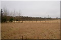
The route of the Dismantled Railway entering Forfar from Gowanbank
Picture taken from the Rosie Roadie about 40 yards north of its junction with Forfar / Montrose Road, looking northwest.
Image: © Alan Morrison
Taken: 11 Mar 2009
0.16 miles
5
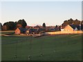
New houses, Forfar
South of Montrose Road, more are being built nearby and filling in as far as the old railway to Dundee.
Image: © Richard Webb
Taken: 11 Jan 2014
0.16 miles
6
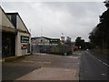
Old Brechin Road, Forfar
Near the Community Hospital and the junction with Station Road.
Image: © Richard Webb
Taken: 23 Jan 2016
0.17 miles
7
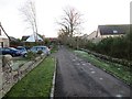
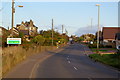
Gowanbank
The road predates the expansion of Forfar and is shown on old maps as a field access road running a few hundred metres southwards from Montrose Road.
Image: © Richard Webb
Taken: 11 Jan 2014
0.17 miles
8
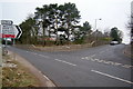
Old Brechin Road, Forfar at its junction with Station Road
Picture taken looking west.
Image: © Alan Morrison
Taken: 11 Mar 2009
0.18 miles
9
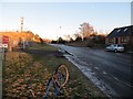
Montrose Road, Forfar
There was a bridge here which carried the railway to Broughty Ferry.
Image: © Richard Webb
Taken: 11 Jan 2014
0.20 miles
10
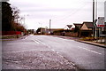
Old Brechin Road, Forfar
Picture taken from Old Brechin Road, Forfar at its junction with Station Road.
Image: © Alan Morrison
Taken: 16 Feb 2009
0.20 miles