IMAGES TAKEN NEAR TO
Kirkbuddo, FORFAR, DD8 2NL
Introduction
This page details the photographs taken nearby to DD8 2NL by members of the Geograph project.
The Geograph project started in 2005 with the aim of publishing, organising and preserving representative images for every square kilometre of Great Britain, Ireland and the Isle of Man.

There are currently over 7.5m images from over14,400 individuals and you can help contribute to the project by visiting https://www.geograph.org.uk
Image Map
Images are licensed for reuse under creativecommons.org/licenses/by-sa/2.0
Notes
- Clicking on the map will re-center to the selected point.
- The higher the marker number, the further away the image location is from the centre of the postcode.
Image Listing (13 Images Found)
Images are licensed for reuse under creativecommons.org/licenses/by-sa/2.0
Image
Details
Distance
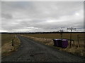
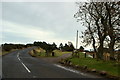
1
Dismantled Railway, north of the old Kirkbuddo Railway Station
Picture taken from the Railway Bridge on the Whigstreet / Kirkbuddo Road. Greenhillock Farm can be seen to the right.
Image: © Alan Morrison
Taken: 15 Feb 2009
0.04 miles
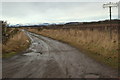
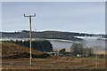
2
Farm road to Greenhillock and Lower Green Hillock
Image: © Douglas Nelson
Taken: 25 Feb 2016
0.05 miles
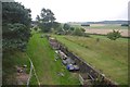
3
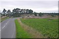
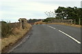
B9127, Kirkbuddo
A bridge crosses the trackbed of the Forfar Direct Line at the site of Kirkbuddo Station.
Image: © Richard Webb
Taken: 1 Sep 2018
0.09 miles
4
Kirkbuddo Railway Station (Converted)
Image: © Alan Morrison
Taken: 15 Feb 2009
0.10 miles
6
Site of Kirkbuddo Station
On the Forfar Direct Line which closed to freight in 1967.
Image: © Richard Webb
Taken: 1 Sep 2018
0.11 miles
8
Railway Bridge at Kirkbuddo
The photo was taken from the Whigstreet / Kirkbuddo Road. The Forfar / Kirkbuddo / Dundee trains ran under this bridge in days gone by.
Image: © Alan Morrison
Taken: 15 Feb 2009
0.12 miles
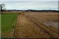
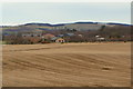
9
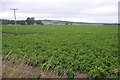
Potatoes, Kirkbuddo
Some of Angus' potato crop prior to defoliation.
Image: © Richard Webb
Taken: 1 Sep 2018
0.14 miles