IMAGES TAKEN NEAR TO
FORFAR, DD8 2NJ
Introduction
This page details the photographs taken nearby to DD8 2NJ by members of the Geograph project.
The Geograph project started in 2005 with the aim of publishing, organising and preserving representative images for every square kilometre of Great Britain, Ireland and the Isle of Man.

There are currently over 7.5m images from over14,400 individuals and you can help contribute to the project by visiting https://www.geograph.org.uk
Image Map
Images are licensed for reuse under creativecommons.org/licenses/by-sa/2.0
Notes
- Clicking on the map will re-center to the selected point.
- The higher the marker number, the further away the image location is from the centre of the postcode.
Image Listing (11 Images Found)
Images are licensed for reuse under creativecommons.org/licenses/by-sa/2.0
Image
Details
Distance
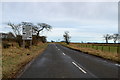
2
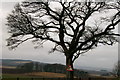
Ahem! Road sign and tree at Kirkbuddo
Image: © Gwen and James Anderson
Taken: 12 Feb 2006
0.11 miles
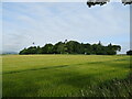
3
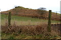
Cairn near Newlands, Kirkbuddo
Picture taken from Greenhillock / Mains of Kirkbuddo Road.
Image: © Alan Morrison
Taken: 15 Feb 2009
0.13 miles
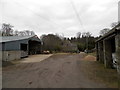
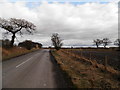
5
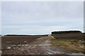
Road to Agricultural Land near Kirkbuddo
Photo taken from Greenhillock Farm road end.
Image: © Alan Morrison
Taken: 15 Feb 2009
0.20 miles
7
View of Kirkbuddo Crossroads
Picture taken from the Whigstreet Road.
Image: © Alan Morrison
Taken: 15 Feb 2009
0.21 miles
8
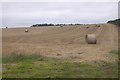
Round bales, Kirkbuddo
Spring barley harvest.
Image: © Richard Webb
Taken: 1 Sep 2018
0.22 miles
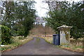
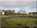
9
Crossroads at Kirkbuddo
Country road approaching the B978
Image: © Douglas Nelson
Taken: 25 Feb 2016
0.24 miles
10
B-road crossroads at Kirkbuddo
The crossroads of the B978 and B9127 at Kirkbuddo.
Image: © Scott Cormie
Taken: 3 Jan 2020
0.24 miles