
IMAGES TAKEN NEAR TO
Priory Court, FORFAR, DD8 2EA
Introduction
This page details the photographs taken nearby to Priory Court, DD8 2EA by members of the Geograph project.
The Geograph project started in 2005 with the aim of publishing, organising and preserving representative images for every square kilometre of Great Britain, Ireland and the Isle of Man.

There are currently over 7.5m images from over14,400 individuals and you can help contribute to the project by visiting https://www.geograph.org.uk
Image Map
Images are licensed for reuse under creativecommons.org/licenses/by-sa/2.0
Notes
- Clicking on the map will re-center to the selected point.
- The higher the marker number, the further away the image location is from the centre of the postcode.
Image Listing (97 Images Found)
Images are licensed for reuse under creativecommons.org/licenses/by-sa/2.0
Image
Details
Distance
1
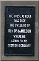
Plaque
This plaque is on the garden wall of Ingleside Image]
Image: © Anne Burgess
Taken: 23 May 2007
0.01 miles
2
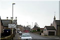
Prior Road, Forfar approaching its junction with Arbroath Road
Picture taken looking southwest.
Image: © Alan Morrison
Taken: 11 Mar 2009
0.02 miles
4
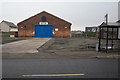
Bus Garage in Prior Road, Forfar
Picture taken looking north. This Bus Garage has recently been closed.
Image: © Alan Morrison
Taken: 11 Mar 2009
0.04 miles
5
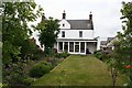
Ingleside
This 18th century house, now sadly disfigured by a modern conservatory, was the home or Dr Jamieson, who compiled a dictionary of the Scots language. A veterinary practice now operates in the premises. There is a commemorative plaque Image]
Image: © Anne Burgess
Taken: 23 May 2007
0.04 miles
6
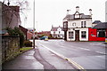
Arbroath Road, Forfar at its junction with Montrose Road
The Vollies Public House can clearly be seen.
Image: © Alan Morrison
Taken: 16 Feb 2009
0.04 miles
7
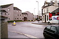
Montrose Road, Forfar at its junction with Arbroath Road
The Vollies Public House can be seen on the right of the picture.
Image: © Alan Morrison
Taken: 16 Feb 2009
0.04 miles
8
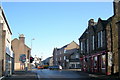
East High Street, Forfar at its junction with North Street and South Street
North Street is to the left and South Street is to the right.
Image: © Alan Morrison
Taken: 18 Feb 2010
0.04 miles
9
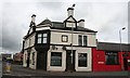
The Vollies
The Volunteer Arms has long stood between Prior Road and Montrose Road at their junction with Arbroath Road. It now seems to have a trendy new name.
Image: © Anne Burgess
Taken: 23 May 2007
0.04 miles
10

Road junction to housing off East High Street, Forfar
Image: © Steven Brown
Taken: 22 Jul 2025
0.04 miles