
IMAGES TAKEN NEAR TO
St. James Road, FORFAR, DD8 2AQ
Introduction
This page details the photographs taken nearby to St. James Road, DD8 2AQ by members of the Geograph project.
The Geograph project started in 2005 with the aim of publishing, organising and preserving representative images for every square kilometre of Great Britain, Ireland and the Isle of Man.

There are currently over 7.5m images from over14,400 individuals and you can help contribute to the project by visiting https://www.geograph.org.uk
Image Map
Images are licensed for reuse under creativecommons.org/licenses/by-sa/2.0
Notes
- Clicking on the map will re-center to the selected point.
- The higher the marker number, the further away the image location is from the centre of the postcode.
Image Listing (221 Images Found)
Images are licensed for reuse under creativecommons.org/licenses/by-sa/2.0
Image
Details
Distance
1
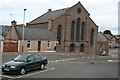
St James Church
This former Church of Scotland is now disused. I see that it has recently been boarded up - last time I looked the windows had all been broken by vandals.
Image: © Anne Burgess
Taken: 23 May 2007
0.01 miles
2
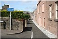
Sparrowcroft
This is the route into the town centre recommended by various satellite navigation systems. Note the sign saying that it is unsuitable for through traffic, and that the lane is only just wide enough for a car, and much too narrow for a large van or lorry. If that weren't bad enough, the routes require a *left* turn into it through an angle of about 150º! The AA online Travel Planner also featured this convoluted route but I am pleased to report that after it had been drawn to their attention it has been corrected.
Image: © Anne Burgess
Taken: 31 Jul 2009
0.02 miles
3
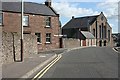
St James Road
The kirk is the now disused St James' Kirk. On the left is the extremely sharp left turn into Sparrowcroft, which, believe it or not, is the recommended route into the town centre on the AA online travel planner, and, I gather, also in various satellite navigation systems. See Image] for the view into Sparrowcroft.
Image: © Anne Burgess
Taken: 31 Jul 2009
0.02 miles
4
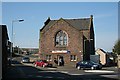
Results Fitness Studio
The fitness studio occupies the lower floor of the otherwise disused St James' Kirk. The rising street to its left is St James' Road, and that to the right is Chapel Street.
Image: © Anne Burgess
Taken: 20 Apr 2009
0.02 miles
5
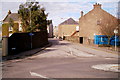
Coutties Wynd, Forfar
Photo taken from Academy Street, looking north. The street at the far end of the picture is East High Street.
Image: © Alan Morrison
Taken: 17 Feb 2009
0.03 miles
6
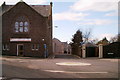
View of Chapel Street, Forfar
Photo taken from Academy Street, Forfar.
Image: © Alan Morrison
Taken: 17 Feb 2009
0.03 miles
7
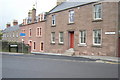
Sparrowcroft, Forfar at its junction with St James Road
Picture taken looking northwest.
Image: © Alan Morrison
Taken: 11 Mar 2009
0.03 miles
8
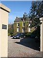
Mansfield House
This elegant Georgian house is tucked away inside its gates just beside the junction of Chapel Street and Coutties Wynd.
Image: © Anne Burgess
Taken: 20 Apr 2009
0.04 miles
9
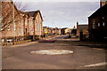
View of Academy Street, Forfar
Photo taken from its junction with St. James Road and Chapel Street.
Image: © Alan Morrison
Taken: 17 Feb 2009
0.04 miles
10
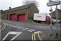
View of Newmonthill, Forfar
Picture taken from near its junction with St James Road, looking southeast.
Image: © Alan Morrison
Taken: 11 Mar 2009
0.04 miles