IMAGES TAKEN NEAR TO
Oswald Street, DD7 7DL
Introduction
This page details the photographs taken nearby to Oswald Street, DD7 7DL by members of the Geograph project.
The Geograph project started in 2005 with the aim of publishing, organising and preserving representative images for every square kilometre of Great Britain, Ireland and the Isle of Man.

There are currently over 7.5m images from over14,400 individuals and you can help contribute to the project by visiting https://www.geograph.org.uk
Image Map
Images are licensed for reuse under creativecommons.org/licenses/by-sa/2.0
Notes
- Clicking on the map will re-center to the selected point.
- The higher the marker number, the further away the image location is from the centre of the postcode.
Image Listing (8 Images Found)
Images are licensed for reuse under creativecommons.org/licenses/by-sa/2.0
Image
Details
Distance
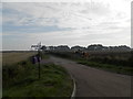
2
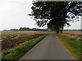
Pitskelly Farm
Pitskelly, viewed from the road to the west.
Image: © Scott Cormie
Taken: 6 May 2018
0.10 miles
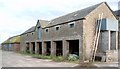
3
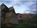
Potato boxes at Pitskelly Farm
Image: © Gwen and James Anderson
Taken: 26 Jun 2007
0.11 miles
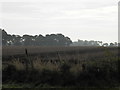
6
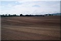
Farmland, Mains of Ravensby
With the farm in the background.
Image: © Gwen and James Anderson
Taken: 1 Jul 2007
0.19 miles
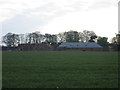
7
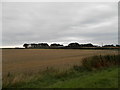
Field near Pitskelly
All that remains of the crop is stubble.
Image: © Douglas Nelson
Taken: 20 Sep 2014
0.21 miles