
IMAGES TAKEN NEAR TO
Newton Crescent, CARNOUSTIE, DD7 6JD
Introduction
This page details the photographs taken nearby to Newton Crescent, DD7 6JD by members of the Geograph project.
The Geograph project started in 2005 with the aim of publishing, organising and preserving representative images for every square kilometre of Great Britain, Ireland and the Isle of Man.

There are currently over 7.5m images from over14,400 individuals and you can help contribute to the project by visiting https://www.geograph.org.uk
Image Map
Images are licensed for reuse under creativecommons.org/licenses/by-sa/2.0
Notes
- Clicking on the map will re-center to the selected point.
- The higher the marker number, the further away the image location is from the centre of the postcode.
Image Listing (9 Images Found)
Images are licensed for reuse under creativecommons.org/licenses/by-sa/2.0
Image
Details
Distance
1
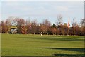
Park, Carnoustie
Between Newton Road and Carlogie Road. A pair of the ugly punning Angus Council signs left over from The Open lurk beyond the trees on Carlogie Road.
Image: © Richard Webb
Taken: 24 Dec 2014
0.15 miles
4
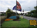
Green and bunker, Carnoustie entrance
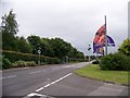
The entrance to Carnoustie on the A930 from the north, featuring banners and a tiny green and bunker.
Image: © Scott Cormie
Taken: 14 Aug 2018
0.20 miles
5
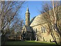
Church of the Holy Rood
Church of the Holy Rood Episcopal Church in Carnoustie, viewed from the corner of the street to the east.
Image: © Scott Cormie
Taken: 4 Jan 2022
0.22 miles
6
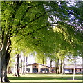
Beech trees, Carnoustie House Grounds
The park is well appointed with mature beech trees. The foliage is newly unfurled and a fresh translucent lime green. Woodlands Primary School is visible in the background. The school opened in 2007 and as part of an upgrading and replacement programme by Angus Council.
Image: © Gwen and James Anderson
Taken: 12 May 2009
0.23 miles
7

Where in the World?
The Arbroath Royal British Legion Band marching by at the 2007 Carnoustie Gala. This year's theme was 'Where in the World?' and the Band led a procession of Tractors, local youth organisations and decorated, themed 'floats' through the streets of the town and up to Carnoustie House Grounds.
Image: © Gwen and James Anderson
Taken: 7 Jul 2007
0.23 miles
8
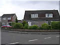
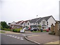
Modern housing on the outskirts of Carnoustie
This housing was built in the 1970s in the area to the east of the A class road which runs through the square.
Image: © Val Vannet
Taken: 30 May 2005
0.25 miles
9
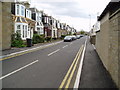
Ireland Street, Carnoustie
View from Station Road showing traditional Scottish housing, built in late 19th/early 20th centuries
Image: © Neil Craven
Taken: 28 Apr 2004
0.25 miles