1
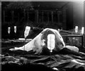
Church Street, Carnoustie, circa 1912
Captioned 'Sergs Wives at Carnoustie', referring to the wives of Sergeants from the 3rd Lowland Brigade of the Royal Field Artillery, who were doing their annual training at nearby Barry Buddon in 1912.
Photograph taken by contributor's grandfather, Alexander Wilson Motion (1881-1956), who was himself a Sergeant in the Brigade.
Image: © Alexander Wilson Motion
Taken: Unknown
0.03 miles
2
Kinloch Arms Hotel, Carnoustie
The hotel is on the High Street. For a closer view of the sign
Image
Image: © Maigheach-gheal
Taken: 30 Mar 2010
0.03 miles
3
Philip Street, Carnoustie
Looking towards Lochty Street from Green Lane. A number of older buildings exist amongst the victorian and newer residential properties at this end of the street. The former dairy buildings on the north corner of the junction with lochty street is the most notable.
Image: © Gwen and James Anderson
Taken: 12 Feb 2009
0.04 miles
4
Sign for the Kinloch Arms Hotel
A sign showing the reason for Carnoustie's fame.
Image: © Maigheach-gheal
Taken: 30 Mar 2010
0.04 miles
5
Sundial in Carnoustie
Vertically mounted sundial from 2003, on a plinth in a circular paved area, north of the High Street in Carnoustie.
Image: © Scott Cormie
Taken: 4 Jan 2022
0.06 miles
6
Church Street
Shops beside junction with Station Road
Image: © Jim Smillie
Taken: 21 Nov 2015
0.06 miles
7
Sign for Berryfield allotments, Carnoustie
The allotments are managed by Carnoustie Allotments Association.
Image: © Gwen and James Anderson
Taken: 25 Apr 2009
0.06 miles
8
Green Lane, Carnoustie
This small lane connects Philip Street and Maule Street.
Image: © Gwen and James Anderson
Taken: 12 Feb 2009
0.07 miles
9
Berryfield allotments, Carnoustie
The relatively new allotments are now packed with vegetable seedlings. However, it is still early in the season and fleece is still in evidence to protect the seedlings from frost.
Berryfield is the first allotment to be established in Carnoustie and the newest in Angus.
Image: © Gwen and James Anderson
Taken: 25 Apr 2009
0.08 miles
10
Station Road at its junction with Church Street, Carnoustie
Image: © Alan Morrison
Taken: 29 Dec 2008
0.08 miles


