
IMAGES TAKEN NEAR TO
Lundin Crescent, TAYPORT, DD6 9EF
Introduction
This page details the photographs taken nearby to Lundin Crescent, DD6 9EF by members of the Geograph project.
The Geograph project started in 2005 with the aim of publishing, organising and preserving representative images for every square kilometre of Great Britain, Ireland and the Isle of Man.

There are currently over 7.5m images from over14,400 individuals and you can help contribute to the project by visiting https://www.geograph.org.uk
Image Map
Images are licensed for reuse under creativecommons.org/licenses/by-sa/2.0
Notes
- Clicking on the map will re-center to the selected point.
- The higher the marker number, the further away the image location is from the centre of the postcode.
Image Listing (44 Images Found)
Images are licensed for reuse under creativecommons.org/licenses/by-sa/2.0
Image
Details
Distance
1

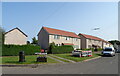
Shanwell Road
Edge of Tayport and one of the ways into Tentsmuir Forest. Small shop on the right.
Image: © Richard Webb
Taken: 6 Aug 2009
0.02 miles
3
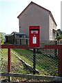
Elizabethan postbox on Shanwell Road South, Tayport
Postbox No. DD6 247.
Image: © JThomas
Taken: 19 Jul 2021
0.07 miles
4
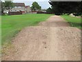
BMX track, Lundin
A piece of hummocky common ground is used as a bike racing track.
Image: © Richard Webb
Taken: 31 Jul 2011
0.08 miles
5
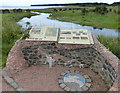
Information boards at the Tentsmuir National Nature Reserve
The Tentsmuir National Nature Reserve is made up of three parts, Morton Lochs, Tentsmuir Point and Tayport Heath, it is managed by Scottish Natural Heritage. The adjoining Tentsmuir Forest is managed by the Forestry Commission Scotland.
Image: © Mat Fascione
Taken: 26 Jun 2017
0.09 miles
6
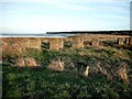
WW2 coastal defences at Lundin Bridge Tayport
View from West at Lundin Bridge Tayport of coastal defences aimed at stopping invading tanks with Tentsmuir Forest and Nature Reserve and Tay Estuary beyond
Image: © Christopher Gillan
Taken: 30 Oct 2005
0.10 miles
9
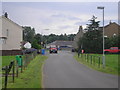
Links Road North
The view of the Fife Coastal path on Links Road North in Tayport. At the junction the Coastal Path follows the main road on the left hand branch of the T junction.
Image: © Sandy Gemmill
Taken: 14 Aug 2012
0.11 miles
10
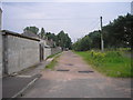
The route of the former railway from Tayport to Leuchars.
Image: © Sandy Gemmill
Taken: 14 Aug 2012
0.11 miles