IMAGES TAKEN NEAR TO
NEWPORT-ON-TAY, DD6 8RD
Introduction
This page details the photographs taken nearby to DD6 8RD by members of the Geograph project.
The Geograph project started in 2005 with the aim of publishing, organising and preserving representative images for every square kilometre of Great Britain, Ireland and the Isle of Man.

There are currently over 7.5m images from over14,400 individuals and you can help contribute to the project by visiting https://www.geograph.org.uk
Image Map
Images are licensed for reuse under creativecommons.org/licenses/by-sa/2.0
Notes
- Clicking on the map will re-center to the selected point.
- The higher the marker number, the further away the image location is from the centre of the postcode.
Image Listing (11 Images Found)
Images are licensed for reuse under creativecommons.org/licenses/by-sa/2.0
Image
Details
Distance
1
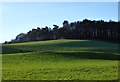
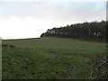
Knockhill Wood
The slopes of Knock Hill from the unclassified road at Wester Friarton farm cottages.
Image: © Jackie Proven
Taken: 4 Jan 2015
0.08 miles
2
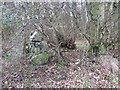
Remnant of wall, Seggieden
There is an Ordnance Survey rivet benchmark on this wall. See Image
Image: © Becky Williamson
Taken: 13 Mar 2021
0.09 miles
3
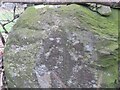
Rivet on wall, Seggieden
Ordnance Survey rivet benchmark, described on database at https://www.bench-marks.org.uk/bm143008. See also Image
Image: © Becky Williamson
Taken: 13 Mar 2021
0.09 miles
4
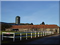
Wester Friarton farm buildings
A well-kept entrance to Wester Friarton farmyard
Image: © Jackie Proven
Taken: 4 Jan 2015
0.10 miles
5
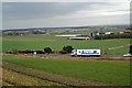
Polytunnels by Wester Friarton
Fields full of polytunnels between the A92 and A914, near Forgan
Image: © Jackie Proven
Taken: 4 Jan 2015
0.13 miles
6
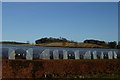
Towards Wester Friarton
Looking down on Wester Friaton Farm across the A92T and farmland around St Fort.
Image: © Jim Bain
Taken: 15 Feb 2007
0.13 miles
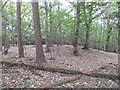
8
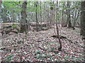
Quarry, Knock Hill
Near the summit. Knock Hill has been quarried in the past. There were a lot of shed sycamore leaves on the ground - due to near drought conditions.
Image: © Richard Webb
Taken: 21 Aug 2022
0.18 miles
9
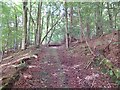
Quarry road, Seggiedean
Knock Hill has been quarried in the past.
Image: © Richard Webb
Taken: 21 Aug 2022
0.21 miles