
IMAGES TAKEN NEAR TO
Navarre Street, DUNDEE, DD5 2TX
Introduction
This page details the photographs taken nearby to Navarre Street, DD5 2TX by members of the Geograph project.
The Geograph project started in 2005 with the aim of publishing, organising and preserving representative images for every square kilometre of Great Britain, Ireland and the Isle of Man.

There are currently over 7.5m images from over14,400 individuals and you can help contribute to the project by visiting https://www.geograph.org.uk
Image Map
Images are licensed for reuse under creativecommons.org/licenses/by-sa/2.0
Notes
- Clicking on the map will re-center to the selected point.
- The higher the marker number, the further away the image location is from the centre of the postcode.
Image Listing (8 Images Found)
Images are licensed for reuse under creativecommons.org/licenses/by-sa/2.0
Image
Details
Distance
2
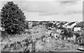
Site of Barnhill Station
Hardly anything to be seen, but this - looking towards Forfar - was the site of Barnhill station on the Dundee East - Forfar branch (closed to passengers 10/1/55, to Goods 9/10/67).
Image: © Ben Brooksbank
Taken: 21 Sep 1974
0.18 miles
3
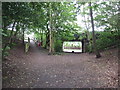
Footpath and cycle path on line of former railway
The bridge is all that remains of the railway infrastructure at this point
Image: © Douglas Nelson
Taken: 1 Jul 2015
0.19 miles
5

Barnhill St Margaret's Church
The south elevation of Barnhill St Margaret's Church viewed from Guthrie Terrace.
Image: © Scott Cormie
Taken: 2 Jan 2022
0.23 miles
6
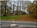
Church through the trees
Barnhill St Margarets Church on Guthrie Terrace
Image: © Jim Smillie
Taken: 29 Oct 2022
0.23 miles
7

The main road running under the Barnhill railway bridge
The bridge carried the former Dundee to Forfar railway and this dip would flood frequently.
Image: © Elliott Simpson
Taken: 1 Aug 1966
0.24 miles
8

Guthrie Terrace
On the outskirts of Broughty Ferry.
Image: © Mary and Angus Hogg
Taken: 18 Nov 2018
0.25 miles