IMAGES TAKEN NEAR TO
Fintryside, DUNDEE, DD4 9JY
Introduction
This page details the photographs taken nearby to Fintryside, DD4 9JY by members of the Geograph project.
The Geograph project started in 2005 with the aim of publishing, organising and preserving representative images for every square kilometre of Great Britain, Ireland and the Isle of Man.

There are currently over 7.5m images from over14,400 individuals and you can help contribute to the project by visiting https://www.geograph.org.uk
Image Map (Loading...)


Getting Data...Please wait
Leaflet Map data © OpenStreetMap
Images are licensed for reuse under creativecommons.org/licenses/by-sa/2.0
Notes
- Clicking on the map will re-center to the selected point.
- The higher the marker number, the further away the image location is from the centre of the postcode.
Image Listing (13 Images Found)
Images are licensed for reuse under creativecommons.org/licenses/by-sa/2.0
Image
Details
Distance
2
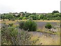
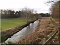
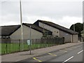
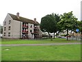
Brownfield site, Longhaugh
A site awaiting redevelopment, some of it is taken up by the Pitkerro Care Centre. This has long been an industrial area, using dams along the Dighty Burn as an energy resource. The main industry was bleaching and this location is called Dundee Bleachfields on older maps. It was well developed by 1850.
Image: © Richard Webb
Taken: 15 Aug 2013
0.12 miles
3
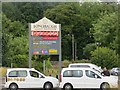
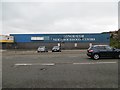
Taxis, Longhaugh
The sign suggests that the community centre site is due for development.
Image: © Richard Webb
Taken: 15 Aug 2013
0.14 miles
4
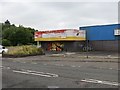
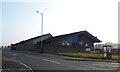
Longhaugh Neighbourhood Centre
A derelict Iceland.
Image: © Richard Webb
Taken: 15 Aug 2013
0.15 miles
6
Longhaugh Neighbourhood Centre
It was still open, although looking derelict. The site is due for redevelopment.
Image: © Richard Webb
Taken: 15 Aug 2013
0.16 miles
9
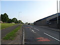
Longhaugh Road
Junction with Fintry Road.
Image: © Richard Webb
Taken: 15 Aug 2013
0.17 miles
10
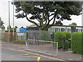
Longhaugh Primary School
One of two primary schools on Longhaugh Road. Term had started and a bell had just gone off for the morning seagull feeding session or break.
Image: © Richard Webb
Taken: 15 Aug 2013
0.18 miles