
IMAGES TAKEN NEAR TO
West School Road, DUNDEE, DD3 8PG
Introduction
This page details the photographs taken nearby to West School Road, DD3 8PG by members of the Geograph project.
The Geograph project started in 2005 with the aim of publishing, organising and preserving representative images for every square kilometre of Great Britain, Ireland and the Isle of Man.

There are currently over 7.5m images from over14,400 individuals and you can help contribute to the project by visiting https://www.geograph.org.uk
Image Map
Images are licensed for reuse under creativecommons.org/licenses/by-sa/2.0
Notes
- Clicking on the map will re-center to the selected point.
- The higher the marker number, the further away the image location is from the centre of the postcode.
Image Listing (7 Images Found)
Images are licensed for reuse under creativecommons.org/licenses/by-sa/2.0
Image
Details
Distance
2

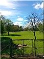
Site of former railway line
Part of the former Dundee Newtyle line, the next stop was Baldovan Station. See ImageAt this point the line crossed over Camperdown Road by a bridge.
Image: © Douglas Nelson
Taken: 6 Oct 2012
0.20 miles
5
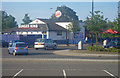
Fast foreign food operation
This convenience food facility is located within the shopping centre. The photographer is standing on the paved parking area in front of the Toys R' Us store.
Image: © C Michael Hogan
Taken: 10 Jun 2011
0.24 miles
6

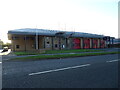
Staffa Place, Dundee
Serving an industrial area.
Image: © Richard Webb
Taken: 23 Sep 2017
0.24 miles
7
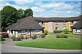
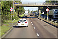
Beild Sheltered Housing, Downfield, Dundee
Somewhat unsubtly built across the road from the local crematorium.
Image: © Elliott Simpson
Taken: 12 Jul 2003
0.24 miles