1
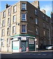
Dens Road Market Dundee
Dens Road Market opened in 1969, there were more than 80 stalls and shops in the market, where you could buy almost anything. It boasted of being Dundee's Petticoat Lane. I spent a great deal of time at the market rummaging through the stalls looking for an priceless antique but if you weren't careful you were more than likely to come out with fleas.
Image: © Mary Rodgers
Taken: 27 Jan 2017
0.12 miles
2
Cotton Road, Dundee
Heading north.
Image: © JThomas
Taken: 23 Oct 2013
0.12 miles
3
Dens Road, Dundee
A damp morning in the city.
Image: © JThomas
Taken: 23 Oct 2013
0.12 miles
4
Meet me at the corner
Tenement flats on Brown Constable Street to the right and Lyon Street to the left and Younas' shop in the middle.
Image: © Ian Paterson
Taken: 1 Nov 2011
0.14 miles
5
Pile of Flats!
The remains of one of the newly demolished Alexander St flats. http://www.bbc.co.uk/news/uk-scotland-tayside-central-14360053 Was there about 6 hours after the demolition and we were still noticeably breathing in the dust in the air. Amazing that such a large building makes such a small pile! See http://www.geograph.org.uk/photo/1626038 and http://www.geograph.org.uk/photo/1455654 to see what they looked like before
Image: © Karen Vernon
Taken: 31 Jul 2011
0.14 miles
6
Hilltown flats demolished
The view from Gallow Hill near Gauldry, across the Tay Rail Bridge, to Dundee. The dust settles following the demolition of the Alexander Road tower blocks in Hilltown.
Image: © Jackie Proven
Taken: 31 Jul 2011
0.15 miles
7
They are ex-flats...
Taken from a similar position to http://www.geograph.org.uk/photo/1455654. What happens when you send the demolition experts in..
Image: © Karen Vernon
Taken: 31 Jul 2011
0.15 miles
8
Brown Constable Road
Going uphill and about to cross Lyon Street.
Image: © Richard Webb
Taken: 24 Dec 2014
0.15 miles
9
Tower block, Hilltown
View of two blocks from Ann Street. There has been some demolition of lower blocks of flats here.
Image: © Richard Webb
Taken: 21 Aug 2009
0.16 miles
10
Former Eagle Mills, Dens Road
"At the close of 1867 there were in Scotland sixteen firms engaged in the manufacture of flax, hemp and jute, who employed 1000 persons or upwards, the aggregate number of operatives being 31,162, or on average of about 1948. (...) The works of eight of the firms are in Dundee, two in Glasgow, two in Greenock, and one each in Aberdeen, Johnstone, Markinch, and Arbroath." -- David Bremner, The Industries Of Scotland, 1869
Image: © kim traynor
Taken: 22 May 2011
0.16 miles


