IMAGES TAKEN NEAR TO
Kilberry Street, DUNDEE, DD3 6DP
Introduction
This page details the photographs taken nearby to Kilberry Street, DD3 6DP by members of the Geograph project.
The Geograph project started in 2005 with the aim of publishing, organising and preserving representative images for every square kilometre of Great Britain, Ireland and the Isle of Man.

There are currently over 7.5m images from over14,400 individuals and you can help contribute to the project by visiting https://www.geograph.org.uk
Image Map
Images are licensed for reuse under creativecommons.org/licenses/by-sa/2.0
Notes
- Clicking on the map will re-center to the selected point.
- The higher the marker number, the further away the image location is from the centre of the postcode.
Image Listing (37 Images Found)
Images are licensed for reuse under creativecommons.org/licenses/by-sa/2.0
Image
Details
Distance
1

Elizabethan postbox on Gardner Road, Dundee
Postbox No. DD3 48.
Image: © JThomas
Taken: 11 Jun 2021
0.06 miles
4
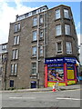
Garner Street News, Dundee
Newsagents with flats over.
Image: © JThomas
Taken: 11 Jun 2021
0.08 miles


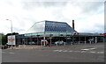
9
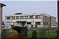
North Tay Centre, Dundee
Offices to let.
Image: © Hugh Venables
Taken: 21 Apr 2019
0.13 miles
10
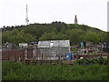
Allotment gardens on the Law
The western and southern slopes of the Law are too steep for building on and are given over to allotment gardens. This view looks up to the War memorial on the summit from the eastern edge of the grid box.
Image: © Val Vannet
Taken: 16 May 2005
0.13 miles